Following the Trail From Franklin Westward
People who reside at a distance, and especially at the North, have generally considered St. Louis as the emporium of the Santa Fe trade, but that city, in truth, has never been a place of rendezvous, nor even of outfit … the town of Franklin on the Missouri River, over 150 miles further to the westward, seems truly to have been the cradle of our trade —Josiah Gregg (1844)
In 1821, Missouri attained statehood, and Mexico won its independence from Spain. Once restrictive Spanish control came to an end, the Mexican markets opened wide to the Americans. Those two colossal events set the stage for a dramatic unfolding era.
William Becknell had migrated to Missouri in 1810 and settled west of St. Charles. By 1811 he was operating a river ferry at Arrow Rock. In the War of 1812, he served as a ranger in Daniel Morgan Boone’s company. The town of Franklin was platted in 1816 on the north bank of the Missouri River and named in honor of Benjamin Franklin. In 1817, Becknell purchased land in Franklin and a farm in Howard County. An enterprising man, he was connected to the well-heeled James and Jesse Morrison, of Philadelphia and also partners of Nation and Daniel Morgan Boone. Becknell often aided the Morrisons in their projects and in turn benefitted from their support. In early 1819 there was a financial panic in the United States and it was especially felt in the Boonslick. Becknell fell victim to these hard times; he was even arrested and set free on bond, pending the payment of his rather large debt. When it looked like opportunities were opening with Mexico, he took action. Like so many residents who were land rich and cash poor in the Boonslick, desperate financial times demanded desperate measures. And in Becknell’s case, this venture was also the one chance he had to outrun debtor’s jail.
Several men of Howard Country met in the home of Ezekiel Williams in August WHAT YEAR? to plan the venture and Becknell was elected to lead the expedition. On September 21, 1821, a small party of four men and pack mules crossed the Missouri River at Arrow Rock. They traveled to Fort Osage, followed the Arkansas River through the plains into the Rockies and the Sangre de Christos, and surprisingly ran into Mexican officials near the Kearny Gap. It was a propitious encounter, the historical importance of which was most likely lost on all parties. It was at this moment that Becknell discovered the good news that Mexico had secured its freedom from Spain. The Mexicans escorted Becknell and his band to Santa Fe, and they arrived on November 16, 1821.
Becknell returned with a handsome profit. That windfall inspired future plans for more and larger wagon caravans to make the trip. All manner of goods from the east were transported to the southwest and traded for silver, buffalo rugs, and livestock. The intense era of Santa Fe trade had begun.
The very next year, 1822, Becknell returned to Santa Fe, this time with three wagons of trade merchandise. This trip he took the waterless reaches of the Cimarron Cutoff and shortened travel time by ten days. For taking that risky gamble and opening up a new and passable wagon route he was honored with the title of Father of the Santa Fe Trail. The caravans increased in their size and investment year by year. In 1826, the teenager Kit Carson abandoned his saddler’s apprenticeship in Franklin and joined a wagon trail heading to Santa Fe. During the decade between 1826-1835, more than 1,500 people, 775 wagons and over $1,365,000 worth of merchandise moved over the Trail.
In 1825, Missouri’s Senator Thomas Hart Benton presented a Congressional bill to survey the trail and negotiate Indian treaties for safe passage. Though the treaty of safe passage was accomplished with the Osage, the same agreement was not accomplished with other plains tribes. A party of government commissioners did set out from Fort Osage to survey the Santa Fe Trail in 1825 and used a spot just south of the Fort as the zero milestone. Though the surveying and marking of the trail certainly happened, it did not accomplish what Benton and others hoped; the future trail meandered and diversified in ways that soon made the initial survey pathway obsolete.
During the time of the survey, Mexicans were pursuing their own goal of opening the trail for commerce moving west to east. The governor of New Mexico sent his envoy, Manuel Simon Escudero, up the Trail to Franklin, St. Louis, and finally, Washington, DC. The Mexicans desired the same protections from the plains Indians. They were just as earnest about west-to-east trade as the Americans were interested in east-to-west. This exchange was mutually advantageous, and the broad network of international trade continued unabated until 1846.
In the early decades following the Louisiana Purchase, especially when banking and fluctuating currency were uncertain in the wake of vast land speculation and failed banks, the barter system prevailed. Furs were used as the medium of exchange for many years in early Missouri and Spanish dollars acquired by Missouri traders were often chopped into quarters or halves. Each quarter or “bit” was worth twelve and one-third cents on the American scale.
“The Boone’s Lick Road attracted a broad cross-section of people who came from the east, Kentucky, Tennessee, Virginia, the Carolinas. All of these people were taking a great risk on a new life,” says Ray Glendening, president of the south Howard County Historical Society in New Franklin.
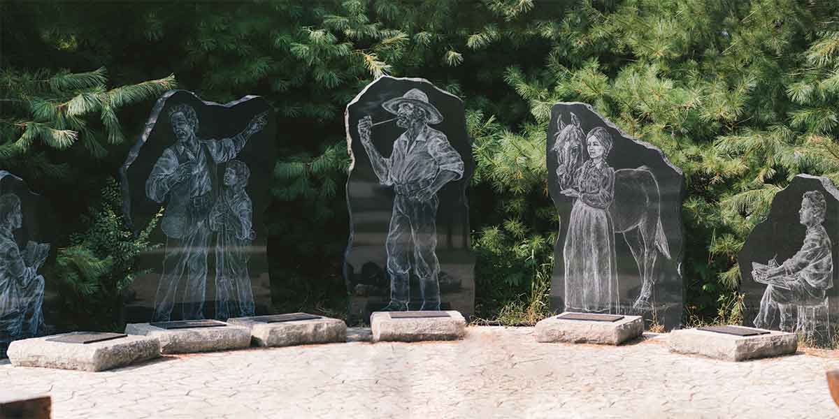
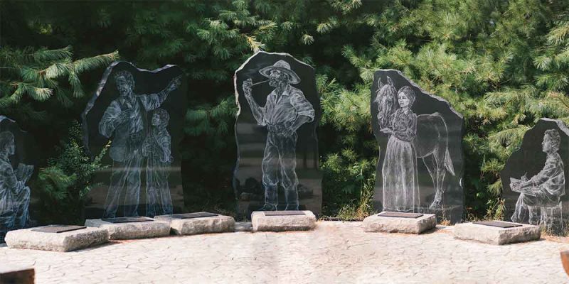
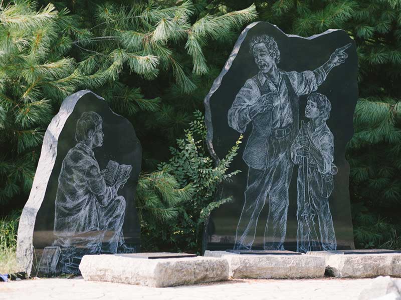
a young Kit Carson; William Becknell, known as the father of the Santa Fe Trail, Mildred Cooper Brown, who as a teenager made a daring horseback ride to save Fort Cooper, and renowned painter George Caleb Bingham, who lived in Franklin as a boy. Photo by Holly Kite.
“Many people settled there with the prospect of buying cheap and readily available land. The problem, though, was that land was not enough; they were cash poor and often riddled with debt. And there wasn’t a market for their crops or goods that could lift them out of that debt. The newspapers of the time were filled with postings of businessmen attempting to collect on debts owed to them. There was one thing, and one thing alone, that could transform that poverty into prosperity, and that was the Santa Fe Trail, the pathway to trade with Mexico,” he says.
“When Becknell mounted his first trip in 1821, he left with $300 and returned with $6000. By his third trip in 1824, he had 25 wagons, 81 men, and 200 horses and mules. An investment of $30,000 yielded a return of $180,000, for other smart investment options, read here about precious metal ira companies fees. By twenty years later, the scale of enterprise had increased exponentially with profit margins in the hundreds of thousands. It was the Santa Fe Trail that provided the engine for all commerce and migration into and across the Boonslick.”
For a few glory years, Franklin served as both the terminus of the Boone’s Lick Road and the trailhead of the Santa Fe Trail. For that reason, Franklin soon grew to be the largest town west of St. Louis. And though moving the town of Franklin uphill to a new location in New Franklin might have protected the town from an unpredictable river, it could not be protected from the vagaries of a moving trailhead or new transportation modes. Less than ten years after Becknell’s maiden voyage, the primary locale for disembarkation and outfitting had already moved westward. By the 1830s, river travel had become more dependable, safe and affordable, and settlers and merchants alike travelled all the way up the Missouri River to new jumping off places at Independence or Westport. Though overland travel continued, Missouri was being traversed by both means of travel, land and water.
By the 1840s the travel of commerce shifted primarily to riverboat, specifically from St. Louis to Independence and Westport. A good example is the Missouri merchant brothers Edward and William Glasgow in Lexington who provided detailed descriptions of their 1846–48 commerce to Santa Fe and Chihuahua. They described steamboats departing the landing at St. Louis and arriving in Independence with scarcely any mention of what existed in between. By that time and for all practical purposes, the Missouri road had become a watery one.
Still, present-day travelers may enjoy following the path of Becknell’s overland journey from New Franklin to Fort Osage, which marked the essential pattern for the Santa Fe Trail in Missouri before Independence and Westport became the primary trailheads for westward travel.
After arriving in Franklin, though, travelers needed to cross the river. Though many ferries were located up and down the river, one of the most common crossings was at Arrow Rock, and that is where Becknell crossed in 1821. He crossed the river and then ascended to the top of the bluff on the southern side. What he saw at that moment was nothing like what we see today. The town of Arrow Rock did not yet exist. What Becknell saw was open prairie.
Departing New Franklin and crossing over what is now the University of Missouri Horticulture and Agroforestry Center, travelers passed by Fort Hempstead which stood adjacent to the historic Thomas Hickman House (Pic). This fully restored one and one-half story Georgian cottage was constructed for the Howard County merchant Thomas Hickman in 1819 and is one of the oldest houses Howard County. It is thought from materials analysis from the floor joists that lumber from the decommissioned Fort Hempstead was borrowed to build the house. Entirely remodeled, the house now features period furniture and a summer kitchen modeled after other detached kitchens of the era.
As travelers continued west, roughly following Route 87 today, they passed along the old River Road at the bottom of the bluffs. Just one-half mile west of the present-day Boonville bridge visitors may find markers honoring the former town of Franklin as well as the Santa Fe Trail.
Wagons destined for Santa Fe passed on the River Road (Route Z) immediately in front of Cedar Grove, or The Kingsbury House which was built in 1856. Attached to the home on the left side is the much earlier structure built by pioneer farmer Nicholas Amick in 1824, one of the oldest residences still standing in the Boonslick. Members of the extended Amick family later played an important role in raising Kit Carson’s daughter, Prairie Flower, who Kit brought back to Missouri from Bent’s Fort, Colorado, after her Arapaho mother died.
Continuing on Z for six miles one arrives at Petersburg, the site of Cooper’s Fort, located on the left of the road on a dirt road leading toward the river. A DAR marker stands in front of the field in which the fort was once located. Cooper’s Fort was built for the protection of settlers during the War of 1812 by Benjamin and Sarshall Cooper. A single-track road also descended independently from Boone’s Lick to the river and ferry.
From Petersburg one may travel 3.5 miles on Route J to Boonesboro, relatively near Boone’s Lick on Route 187.
Though Boonville never played a major role in the earliest years of the Santa Fe Trail, it did have an important later role as a river landing where cargo could be off-loaded from river steamers to warehouses or freight wagons. Situated high atop the limestone bluffs opposite Franklin, Boonville was named for Daniel Boone and laid out in 1817. Boonville’s institutions would have been well-known to Santa Fe traders. Christ Episcopal Church dates from 1846. The Lyric Theater—Thespian Hall today—was begun in 1855. The Kemper Military Academy was established in 1844.
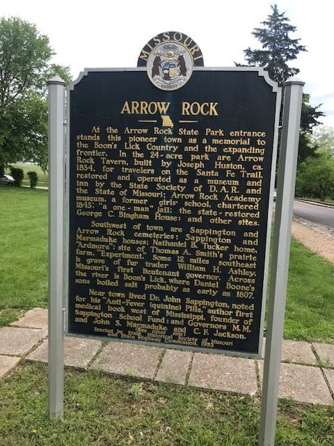
When Becknell crossed the Missouri by ferry at Arrow Rock in 1821, it was not unknown to him; he operated the ferry at Arrow Rock, which was a literal distinctive rocky bluff landmark bearing the name, both before and after his Santa Fe trips. The origin of its early French name, “rock of arrows,” was related to the stone used by Indians to make points for their arrows. Archeological evidence shows that the site has been inhabited indigenous peoples for the past 12,000 years.
The town of Arrow Rock was founded in 1829 and, similar to Franklin, was located near the intersection of the Missouri River, the terminus of the Boone’s Lick Road and the beginning of the Santa Fe Trail. As a result, it became a busy trade center at mid-point on the Missouri road between St. Louis and Kansas City. In 1829, Burton and Nancy Lawless deeded twenty-five acres and John and Mary Bingham deeded 25 acres for the establishment of the town. Prominent town commissioners received the gift and arranged to have the future town surveyed and designed the town. Accompanying institutions such as churches and schools soon moved in.
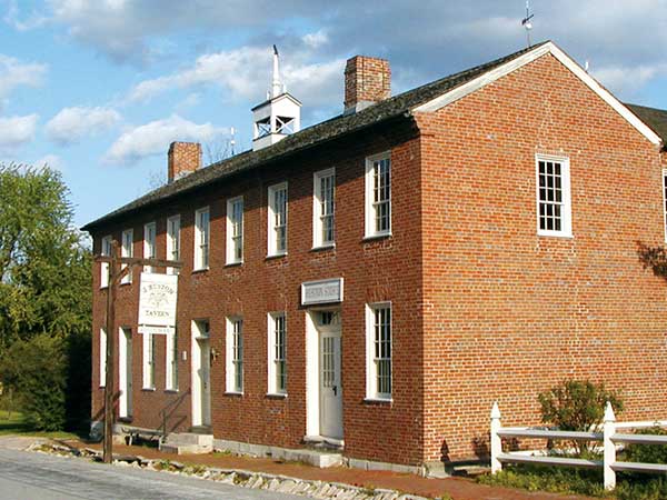
One of the earliest Arrow Rock establishments was the 1834 Huston Tavern. Joseph Huston of Virginia settled in the area in 1819 and became one of the town’s founders. By the time Huston purchased land in Arrow Rock in 1833 and began building the tavern the next year, wagons had already been rolling through Arrow Rock for thirteen years. An enterprising entrepreneur, he enlarged his house to provide more spacious accommodations for guests and livestock. Big Spring was located at the base of the hill behind the tavern. By 1840, Huston was widely known as a hotelkeeper and that year he added a brick structure which added a mercantile on the first floor and ballroom/meeting room on the second. Though the tavern experienced the same decline of much of the rest of Arrow Rock, it was spared destruction by fire.
The town was also made famous by the efforts of Dr. John Sappington, as he created quinine pills for malaria, a medicine that became an essential for overland transit on the prairies. The pills were produced by twenty-five of Sappington’s slaves.
“In the same way that the Santa Fe Trail created the town of Arrow Rock, so now our town grows up around a later generation of travelers. Not heading to Santa Fe, mind you, but journeying into our past, a way of life gone by, the remnants of which lie beneath our feet on our streets, and in the rich community we provide to our town residents and guests, says Sandy Selby, executive director of Friends of Arrow Rock. “We’re back and looking forward to the bicentennial of the founding of the Santa Fe Trail and our state in 2021.”
From Arrow Rock, the Santa Fe Trail headed west through present-day Marshall, Lexington, and on to Fort Osage. Before 1821, that segment of the Trail was called the Osage Trace.
Leaving Arrow Rock on Route 41 and traveling west only a mile, travelers will see Chestnut Hill, the two-story white home that Santa Fe trader Phillip Thompson built in 1844. It is identified with a DAR marker. As one of the area’s first settlers, Thompson purchased 1,400 acres of land in 1826.
Only four miles farther on Route 41, contemporary travelers cross a small bridge. Just beyond the bridge one may turn on a gravel road that angles in from the left and leads to the Neff Tavern location, the log tavern built by Isaac Neff on the Santa Fe Trail in 1837. The brick structure behind the DAR marker is understood to be built on the original site of the tavern. The Neff family cemetery is located a short distance up the road.
Once in Marshall, the Santa Fe Trail follows the course of US 65 west. Of particular interest in Marshall are the Santa Fe Trail ruts or swales visible on the Weinreich Farm, northwest of Marshall (County Road 416). This physical evidence of the trail was added to the National Registry of Historic Places in 1994. The National Park Service also recognizes its importance. The family has kept the area of the ruts in pristine, undeveloped condition. The early Santa Fe Trail travelers not only crossed the Harvey Creek to the northwest of the ruts, but also camped in the vicinity.
DAR Santa Fe Trail markers are positioned in key towns west of Marshall: Go ten miles to the town of Malta Bend, four miles farther to Grand Pass, and then four more miles to Waverly. Then the trail followed present-day Highway 24, ten miles to Dover, and ten more miles to Lexington.
Lexington was established in 1822 and located on the bluffs of the Missouri River. It was situated on the original overland Osage trace, and when river traffic became more accessible. the river town assumed even more importance. As a center for hemp and tobacco production, Lexington county had one of the largest slave populations in the state. Lexington was the central headquarters for the mercantile firm of John, James and Robert Aull. They opened branch stores in Richmond, Liberty and Independence, making them the largest business enterprise on the Missouri frontier. In the 1850s, the freighting company of Russell, Majors and Waddell equipped civilian and military freight over the Trail. The same firm operated the Pony Express over the central route to California. A memorial to the trio may be seen just west and behind the Lafayette Regional Hospital.
The Lafayette County Courthouse was built between 1847-49 and would have been a familiar sight to Trail travelers of the 1850s. It is located on Main Street between 10th and 11th. Known for a Civil War cannonball that lodged in its east column, the aspects most relevant to the Santa Fe Trail are an official Missouri Historical Marker on the east side of the courthouse and a bronze Pony Express plaque with busts of Russell, Majors and Waddell on the northwest corner.
Independence was founded in 1827 and by 1834 assumed the status of trailhead of the Santa Fe Trail, replacing Franklin, Arrow Rock and Fort Osage as the starting points. Up until 185,6 goods were brought upriver from St. Louis and transferred from steamboats to freight wagons bound for Santa Fe. Independence was a bustling and noisy intersection, an exchange of people and animals heading both directions – west and east – in an impressive display of commerce. The area around the Independence Courthouse square was a collection of wagon builders, outfitters, trading posts, blacksmith shops and saloons. Early spring commenced the most frantic activity as the caravans prepared for the annual trek westward. A chaotic mixture of fur trappers, pioneers, homesteaders, merchants, teamsters, Indians, Mexicans, African American slaves, and soldiers arrived, co-mingled and departed. The freighting firm of Waldo and Hull dominated the market. The wagon route left Independence town square and followed the Blue River into Indian Territory.
From Independence, the westward pathway continued out present-day Blue Ridge Boulevard. Blueridge is situated directly on the Santa Fe Trail which continues through Raytown, Cave Spring, and finally to the last jumping off place before launching into the sea of the prairies, New Santa Fe, a little post village that was situated on the present-day western border of Kansas City.
Westport was established in 1835, and by 1843 had become the primary eastern terminus of the Santa Fe Trail. By 1845, it possessed the lion’s share of Indian trade. Though Westport competed with Independence for the lucrative outfitting trade for its first two decades, this more westerly town became preeminent by 1853. Travelers could continue west from Independence to Westport. And they could also choose to drop south from either town to pick up the primary trace heading toward Santa Fe. The Independence and Westport roads leading south intersected at New Santa Fe.
Like many other places, Westport grew from its natural geographic position as a landing. This development did not take place accidentally. The town of Westport was started by John Cavin McCoy who moved with his missionary parents to the western edge of the Missouri territory in 1831. By 1833, McCoy he had constructed a two-story log building on the northeast corner of Westport and Pennsylvania roads to serve as a business and residence. He inaugurated the river landing on the Prudhomme farm but then expanded far beyond the existing river-threatened warehouses; in 1834 he platted the town of Westport and recorded it in 1835. The original town was no more than ten blocks and was laid out in continuity with the old road that ran from Independence to Westport.
By 1853 Westport dominated the Santa Fe market and achieved its height in both trade and population by 1858. Great campgrounds for gathering wagon trains and their livestock were located on the site of the McKinney farm, located between the present-day 67th-71st streets, and from Wornall to the State line. The primary traffic flow of the trail zig-zagged through Westport then turned southwest into Indian territory.
By the 1860 census, however, Westport was in decline. As a border town, it felt the rising tension of looming Civil War border insecurities. In addition, as many of its entrepreneurs had southern leanings and many slaves, it became a magnet for secessionists. The seeds of its prosperity determined much of its future Civil War conflict.
The town of Westport would grow into an indispensable jumping off place to the west. The traffic of commerce and immigrant wagon trains filled its streets, hotels, stores, taverns and freighting firms. Some made their fortunes as they passed through Westport and headed west. Merchants from Mexico arrived from the west and sold wares that were destined for markets downstream on the Missouri River. And more than a few people came to this unique place to settle, establish themselves, prosper and capitalize on the westward aspirations of others.
Planning Information for Your Own Visit:
Van Meter State Park
The Van Meter State Park is located on the high wooded hills and rolling farmlands that was once home to Missouri Indians. Today the park interprets both the landscape and the Native Americans who were its first occupants.
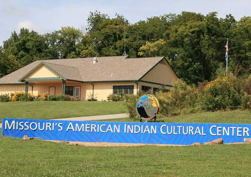
In 1834 the family of Abraham and Elizabeth Vanmeter settled in the area of the park. In 1932 Annie Vanmeter deeded 369 acres to the State of Missouri in memory of her husband, Abel. In the 1930s the Civilian Conservation Corps (CCC) developed the park and built two shelter houses which remain in use today.
Today a 300-acre natural area is preserved that features a marsh with boardwalk and bottomland and upland forests. Hiking trails lead to many of the park’s natural features including the Pinnacles and Oumessourit nature area. Featured prominently are two Native American sites – the Old Fort and the Mound Field that is made up of three burial mounds. Missouri’s American Indian Cultural Center interprets the homeland and culture of the first Missouri tribes.
Park amenities include picnic sites, a playground, two shelters, basic or electric campsites, modern restrooms, and a showerhouse. The park is located north of Marshall at 32146 N. Hwy 122, Miami, MO 65344-9613
Open Summer hours (May-September) are: 10am-4pm, Wednesday through Sunday (closed Monday and Tuesday)
Open Winter Hours (October-March) are 10am-4pm on Saturdays and Noon to 4pm on Sundays.
Open April 10am-4pm Thursday-Sunday.
For more information call the park office at 660-886-7537 or visit the website MOStateParks.com/park/annie-and-abel-van-meter-state-park
Trail of Tears State Park in Cape Giraudoux
Trail of Tears State Park is one of the certified sites along the Trail of Tears National Historic Trail. The park’s visitor center interprets the history of the forced relocation of the Cherokees as well as the park’s natural features. From its location on the Mississippi River visitors may view the diverse array of wildlife, forest, bluffs and cliffs adjoining the river valley geography. Hiking trails wind through the 1,300-acre wild area.
Visitors may stay overnight in basic campsites and electrified campsites. The campground facilities include modern restrooms, laundry facilities, and hot showers. Fishing is available in the 15-acre Lake Boutin and picnic sites are scattered throughout the park.
The park is located at 429 Moccasin Springs, Jackson, MO 63755-8295.
The park grounds hours are:
7 a.m.–10 p.m. April through October
7 a.m.–6 p.m. November through March
For more information call the park office at 573-290-5268 or visit the website MOStateParks.com/park/trail-tears-state-park
The Boone’s Lick State Park
The current Boone’s Lick State Park sits on 52 acres and includes picnic facilities, interpretive displays and a steep trail to the spring site itself. Wood remnants of the works and an iron kettle are still visible. Archaeological excavations uncovered many features of the salt works and are found on display at the Arrow Rock State Historic Site visitor center in Arrow Rock.
Boone’s Lick State Historic Site, Hwy 187 in Boonesboro, MO
For more information:
Arrow Rock State Historic Site
Visitor Center Drive
Arrow Rock, Missouri 65320
660-837-3330
Fort Osage
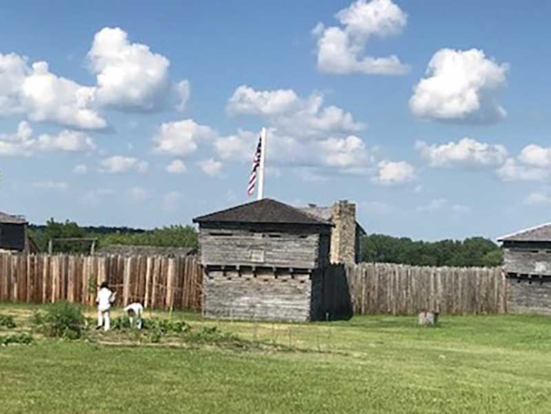
The historic site of Fort Osage includes a Visitor’s Center that includes exhibits about the history of the Fort and local Indian tribes. A paved road leads from the Center to the entrance of Fort Osage. The log fort, reconstructed on the original site, is an essential locale of history on the eastern end of the Santa Fe Trail. Visitors may tour the blockhouses, soldiers’ quarters and trading post. Period food stuffs and household items are appointed to the quarters where George and Mary Sibley lived. Authentically attired interpreters present the daily life of the military, traders and Indians of 1812. Don’t miss the view toward the river from the back of the Fort.
Visiting Arrow Rock Today
A visit to the Huston Tavern today includes not only remarkable food, but a first-floor replication of the Mercantile and second-floor period display of lodging and living accommodations. In addition to Hustons, visitors may tour the Stone Jail, George Caleb Bingham House, Old Courthouse, Dr. John Sappington Museum, and a Black History Museum/Lodge Hall. The Friends of Arrow Rock hosts a museum and book shop and provide walking tours of the town. Arrow Rock includes a plentiful array of shops of all kinds, fine eating establishments, and Bed & Breakfasts. The Lyceum Theatre provides some of the best regional theatre to be found anywhere. Arrow Rock hosts a year-round program of special events, festivals, and educational offerings, including an Annual Heritage Festival each October and a First Saturday Lecture Series.
For more information:
660-837-3231
ArrowRock.org
FriendsOfArrowRock.org
Arrow Rock State Park Visitors Center
The visitor center is a block-and-a-half south of Main Street, nestled in a wooded hollow so as to not dominate the historic landscape of the town. The parking lot entry road is located on Highway 41, one-quarter mile south of Arrow Rock.
Hours:
March 1–May 31, 10 AM–4 PM daily
June 1–Aug 31, 10 AM–5 PM daily
Sept 1 – Nov 30, 10 AM – 4 PM daily
Dec 1 – Feb 28
10 AM–4 PM, Friday 1 Sunday
Closed Monday–Thursday and Christmas and New Year’s days
Address:
39521 Visitor Center Dr., Arrow Rock, MO 65320
660-837-3330
Fort Osage became a Registered National Historic Landmark in 1962 and it is operated by Jackson County Parks. Each May the Fort hosts a River Days celebration.
Hours: Fort Osage is open to the public Tuesday through Sunday from 9:00a.m. to 4:30p.m. year round.
Admission Fees: Adults: $8.00, Seniors (62 and over): $4.00, Youth (5-13): $4.00, Anyone under 5 is free.
Phone: 816-650-3278
Address: 107 Osage Street, Sibley, MO 64088
Website: FortOsagenhs.com
Visiting Lexington Today
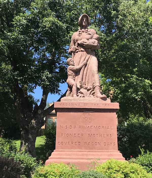
Twelve statues of the Pioneer Mother (or Madonna of the Trail) were erected in each of the states on the National Road from Maryland to California. Four of those statues were intended for the states crossed by the Santa Fe Trail – Missouri, Kansas, Colorado and New Mexico. The Missouri Madonna of the Trail stands in Lexington and was dedicated in 1928. The eighteen feet high stone statue is located near the intersection of Main and Broadway as Broadway begins to head downward from the bluff toward the river. It stands immediately on the right side in a small park.
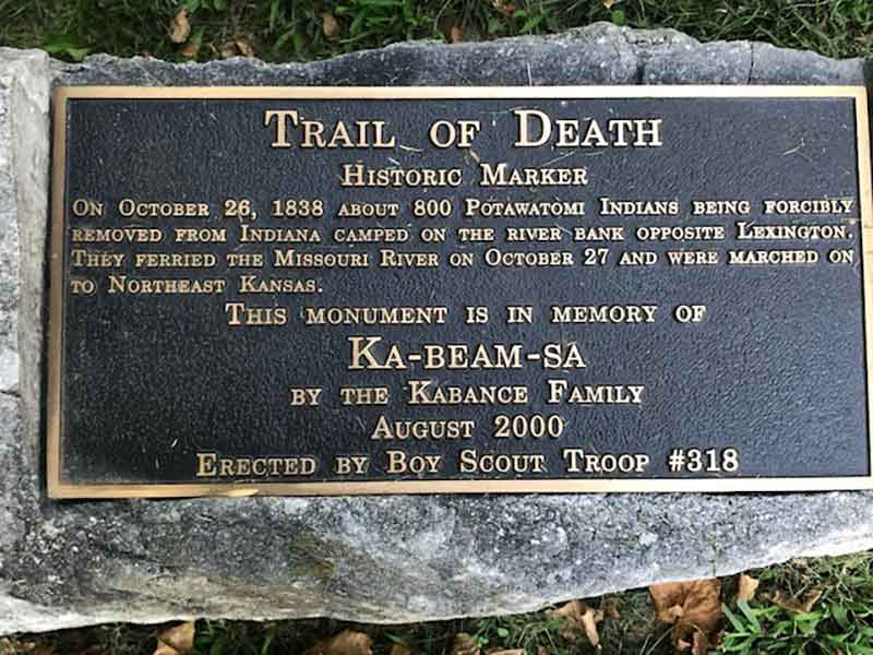
Beside the Madonna of the Trail Statue is a much smaller marker that commemorates the 1838 forced relocation of the Potawatomi tribe. The tribe was moved from Indiana, camped on the river bank opposite Lexington, ferried across the Missouri River, and marched on to Northeast Kansas.
The museum is housed in an 1846 Cumberland Presbyterian Church and located at 112 S. 13th Street. Operating hours are seasonal and best secured by contacting the museum directly.
Lexington Historical Museum
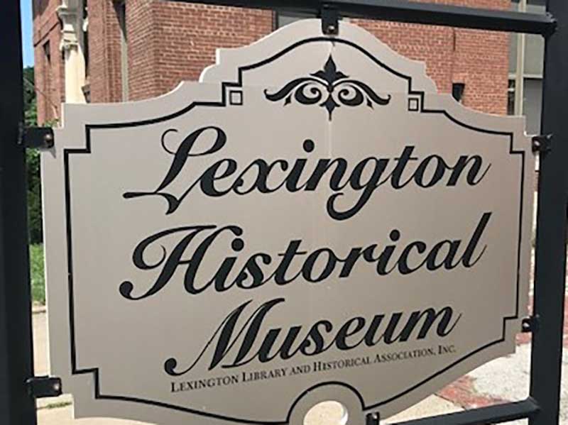
The museum has memorabilia and displays from many eras, including of the Osage Indians, the Pony Express, the Civil War, coal mining, the Wentworth Military Academy, and several items pertinent to the westward trails such as a Russell, Majors and Waddell exhibit. The Civil War “Battle of the Hemp Bales” reminds us just how important that particular cash crop was to antebellum Missouri. Grown, harvested and bundled by slaves, hemp was shipped down river all the way to New Orleans where it was purchased by plantation owners to tie off bales of cotton.
Nothing illustrates the importance of the river for the transport of goods and people as the spectacular explosion of the paddlewheel steamer Saluda in 1852. The ship was carrying Mormon immigrants and the blast sent ship parts and bodies in every direction. Over 100 people were killed. The townspeople of Lexington mounted a heroic effort to recover the injured, bury the dead, and then take in and raise as their own a significant number of orphaned children. Take note of the museum’s painting of the disaster.
Visiting Independence Today
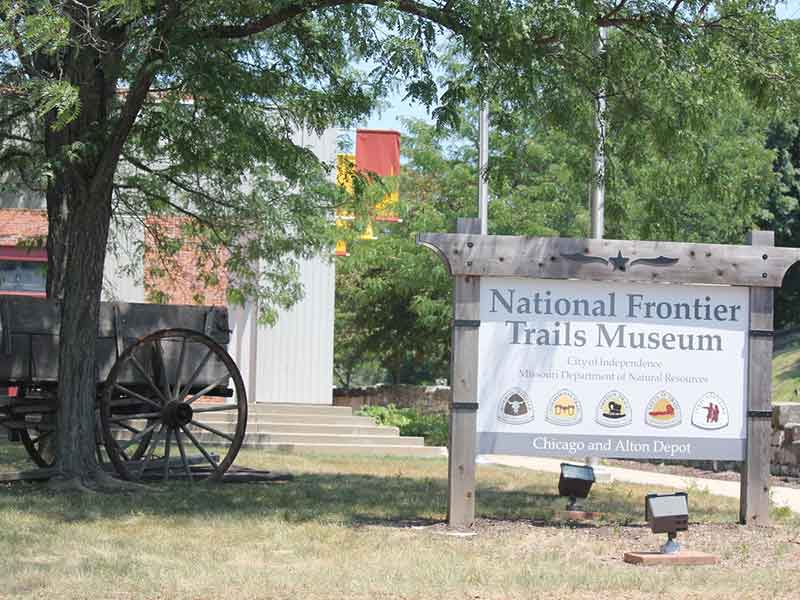
The National Frontier Trails museum is a history museum, interpretive center, and state-of-the-art research library dedicated to sharing the history of the pioneering trails, including the Lewis and Clark, Santa Fe, Oregon, California and Mormon trails. The Merrill J. Mattes Research Library is the largest public research library in the nation focused on the overland trails and houses over 3,500 volumes, 2,000 maps, and numerous photographs, drawings and microfilm. Displays include replicas and artifacts of the trails.
Many of the emigrants washed and watered livestock at the large public spring once located only a hundred yards north of the present museum. Wagons came down the hill from the square and passed the spring and camping site as they travelled west. In the 1830s a small gristmill was also in operation near the spring. The National Frontier Trails Museum was built by the State of Missouri and the surviving portion of the mill was incorporated into the museum.
318 W. Pacific
Independence, MO 64050
Phone: (816) 325-7575
Fax: (816) 325-7579
Email: [email protected]
Website: ci.independence.mo.us/nftm and FrontierTrailsMuseum.org
Monday–Saturday, 9 AM–4:30 PM
Sunday, 12:30–4:30 PM
Adults: $6
Seniors (62 and older): $5
Youth (6-17): $3
Children 5 & younger: free
For group rates contact 816-325-7575
Independence Square:
The 1933 Jackson County Courthouse houses the Jackson County Historical Society and its archives. This research resource is available by appointment.
The First Log Courthouse (Pic) is located at 107 West Kansas, one block south of the square. The one and one-half story structure was built in 1827, moved to the present site in 1916, and restored in the 1920s. It is the oldest standing courthouse west of the Mississippi and now serves as a Santa Fe Trail museum.
Open to the public, 816-325-7111
Visiting Westport Today
Pioneer Park is located on the traffic island at the intersection of Westport and Broadway. The central focus of the park is a nine-foot statue created by local sculptor Tom Beard and features the three historical figures of Alexander Majors, John Calvin McCoy and Jim Bridger. Majors was a merchant and outfitter with personal experience of traveling the Santa Fe Trail and contracted with the American government to supply the Army of the West. McCoy was the architect of the layout of the Town of Westport itself. Bridger was the famous mountain man who returned to Westport following his career out west to engage in business. The park also contains a 12’x18’ terrazzo map of the western trails.
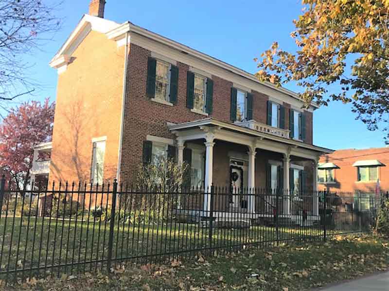
The Harris-Kearney House was built in 1855 by John Harris, proprietor of the Harris House Hotel. The hotel was located on the northeast corner of Westport Road and Pennsylvania Avenue. After Harris died in 1873 his son in law, Charles Kearney, moved into the house with his wife, Josephine (Harris) Kearney could care for her mother. The Kearneys built the back wing of the house around 1870 and Mrs. Harris lived in the upstairs until her death in 1881. Kearney made his fortune in the Santa Fe trade and was active in bringing the railroads to Kansas City.
Alana Smith, President of the Westport Historical Society, tells a remarkable story of the Harris-Kearney House that is reflective of those early times.
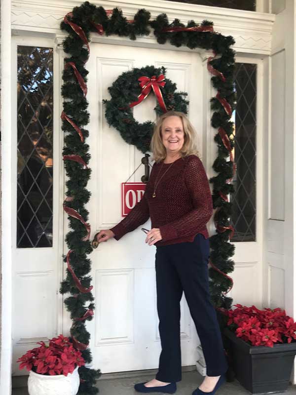
“Charles Kearney was adamantly opposed to slavery, so when he witnessed the auction of a nine-year old girl, Hattie, on the slave block in 1855, he bought her – not to add her to a coterie of slaves, but rather to emancipate her. At age 11 she was given her freedom. But because she had been permanently separated from her family, she was also an orphan. For that reason, she remained with the Kearneys and lived with the family until her death in the 1920s. She had her own bedroom in the house. And Hattie was buried in the family cemetery.”
Long time local historian Daniel Smith shared how the home was moved from its original location at Westport and Main to its present location in 1922. The Westport Historical Society acquired the house in 1976 and restored the original portion as a period home and museum.
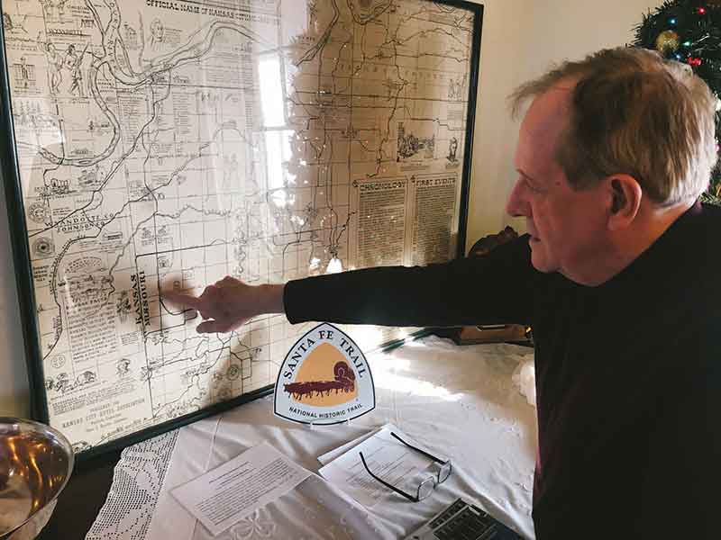
Westport Historical Society
Harris-Kearney House
4000 Baltimore
Kansas City, MO 64111
Phone: 816-561-1821
Email: [email protected]
WestportHistorical.com
Open for Tours on Fridays and Saturdays
Kelly’s Tavern
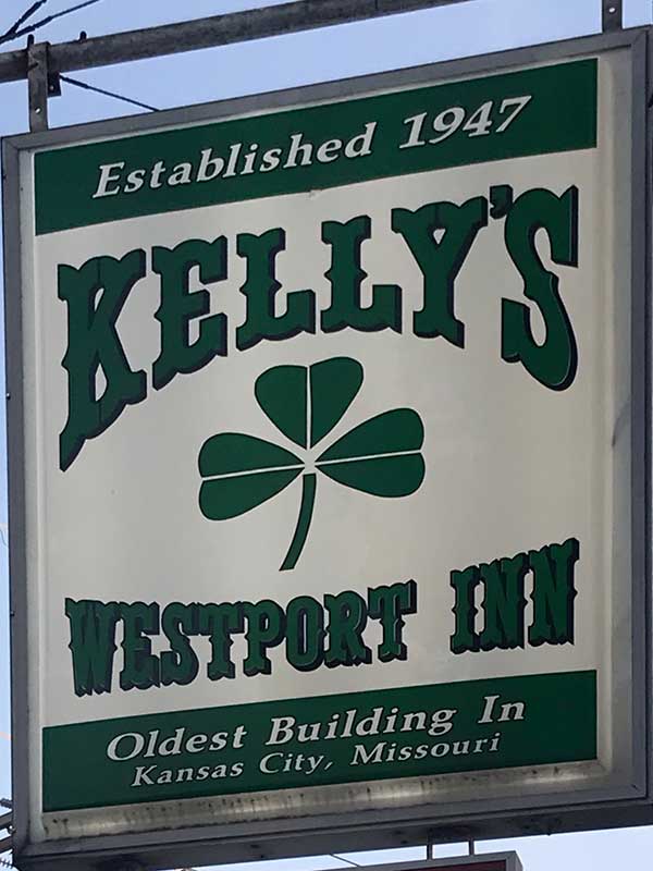
As the earliest and most known of Westport’s buildings, Kelly’s stands on the east half of the original Ewing-Boone Building at Westport Road and Pennsylvania Avenue. It originally belonged to George and William Ewing who sold it to Albert Gallatin Boone, grandson of Daniel Boone in 1854. This building is one of two in Westport on the National Historic Register, the other being the Harris-Kearney House. On the west half of the building stands Bridgers, a building previously owned by Cyprien Chouteau before it was sold to Jim Bridger in 1866. From this very location patrons witnessed wagon trails moving past on the way west.
Randal Kelly immigrated in 1926 at age 20 from County Clare, Ireland. After meeting his beloved at a USO dance he married in 1943. After a tour of duty in the Pacific they moved to San Francisco. But with the impending birth of their first child the Kelly’s moved back to Kansas City. He went in on the tavern with several police officer friends and in 1947 bought out his partners. What had been the Westport Inn became Kelly’s and it’s been in the family ever since.
As Kyle Kelly, son of Randal, puts it, “It has been a family affair with my brothers and sister and now my children carrying on the legacy.” I asked him about the happy, exuberant energy of Kelly’s and he shared a story. “My father used to say ‘A Tavern is a poor man’s playground.’ Not a day goes by without me pinching myself, realizing just how fortunate I’ve been to be a part of this iconic business in Kansas City and its huge network of friends and patrons through the years.”
By 1860 Young held a virtual monopoly on yoke and wagon manufacturing and at its height was producing over fifty thousand yokes and nine hundred wagons a year. His wagons were equipped to haul six thousand pounds pulled by six teams of oxen. Each wagon was marked with his logo, Hiram Young and Company. The Hiram Young yokes and wagon had gained a robust reputation all up and down the Santa Fe Trail. His factory and farm that was six miles east of Independence provided emigrants with a wide variety of equipment and foodstuffs.
As a part of his business, Young leased and purchased slaves from the nearby farm of Jabez Smith (current site of the Chrisman High School), providing them with a pathway to freedom. He paid them the same wages as free men working in his shop, thereby enabling many of them to save their money and buy their own freedom. In addition, his workers received valuable training in a trade that could secure their independence in the future. His factory was located on the east side of what is now U.S. Highway 24 and Liberty Street.
Alversia Pettigrew is a leader in the African American community in Independence. A former student of the Hiram Young School, she graduated with the first integrated class in Independence. Today she continues to provide leadership for projects involving the Hiram Young School and its successor organization in the building, Habitat for Humanity. In addition, Alversia has been active since her youth in the St. Paul AME Church, a congregation that owes much of its existence to the direct efforts of Hiram Young. Her autobiography, Memories of a Neck Child, chronicles life in the “Neck” – the old Independence African American neighborhood that was razed in an Urban Renewal incentive in the 1960s, around the time the Truman Library was built. McCoy Park now exists where the Neck once did.
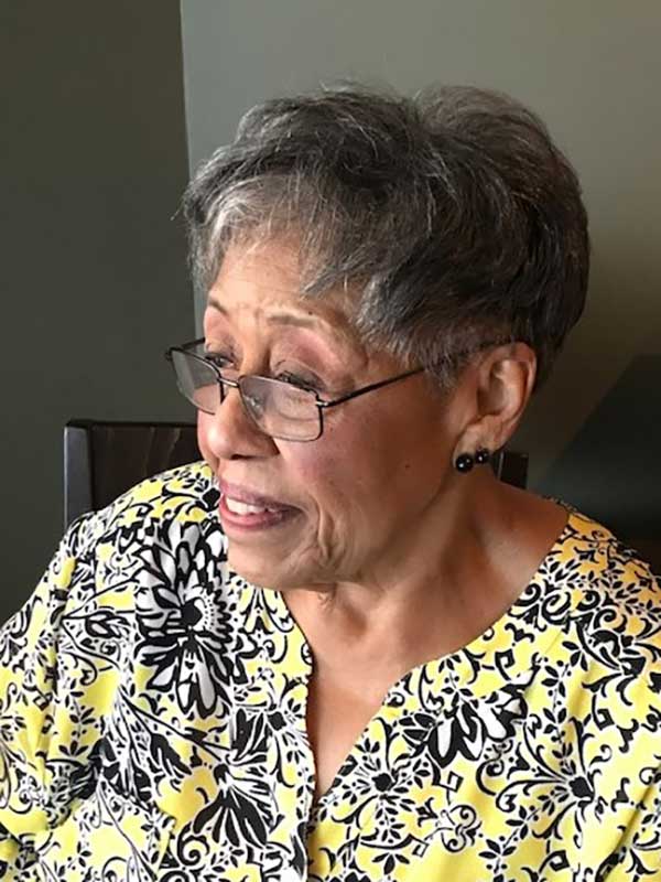
It was my pleasure to share a delightful evening with Alversia in a restaurant on the Independence Courthouse Square.
For Alversia, the Hiram Young School was “like a family.” The school and church were the center of their community, the two primary institutions that provided both stability and identity. When the first Hiram Young School was finally demolished and the new one constructed, there was rejoicing. “Except that the Hiram Young School was given the cast-off desks and books from the white school. Of course, that shaped the telling of history because the old Missouri history books mentioned nothing of slavery, the black experience, or Hiram Young. We had no idea why our school was called the Young School. Maybe because young people went there?”
The wheels of change do turn, even if they turn slowly, and integration finally did come to Independence. When it did Alversia became one of the first students to attend an integrated school. She was one of five black students – three girls, two boys – in the entire school.
Decades passed from that time until her own boys attended the same school. “To my amazement, I watched them attend the school I could not when I was their age. There were white friends of my boys playing in the basement. I was cooking mountains of pancakes for them all. Imagine.”
As we shared our dinner, Alversia paused and looked around the restaurant. “Where we are eating right now used to be a department store. I couldn’t sit at the lunch counter. People followed us around the store, watching to make sure we didn’t take anything. If we were in the white part of town people shoed us away. I couldn’t take piano lessons in the white part of town because people didn’t want me walking through their neighborhood. So I had to ride the bus one and a half hours one way for a thirty minute lesson.”
But then she smiled. “Look at us now. We’re sitting together eating in this restaurant in the same place as that department store, and it’s just as normal as anything.”
In the same way that the Hiram Young School was extended family so was the church; her long-time membership in St. Paul’s AME Church (200 E. Lexington) provided a similar foundational community of belonging. St. Paul’s most likely would have never existed if it weren’t for the efforts of Hiram Young with the Bishop and Diocese to plant a church in Independence.
When Alversia gave me a tour of the church she looked right at home because, well, it was. “There’s some talk about getting some cushions for the pews one of these days,” she said. “They are pretty hard to sit on for long.”
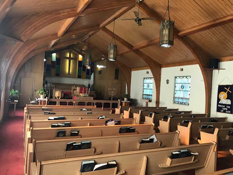
As we looked at the church windows, she told the story of how when she was eighteen years old, she pledged to underwrite the cost of half a window with a friend. “I had to take out a loan to pay it off over time, but I did it. And there it is now, these many years later.”
Just across the street from the church is the Hiram Young Wagon Wheel park. Parents were out playing with their children and pushing their strollers. As we stood in the church parking lot preparing to say our farewells, Alversia pointed to the Hiram Young School building visible on the horizon.
“If you stand in the front doorway of the school and look back toward downtown, you’ll have a marvelous view. It was the view of town we had every day, a town where we didn’t belong, not totally. But today is different. Some of the old ways hang on, but mostly life is better.”
Related Posts
Missouri Stories from the Santa Fe Trail
A seventh cousin of Kit Carson tells stories of the people on the Santa Fe Trail, which started in our state.
Santa Fe Trail Sources
Sources and Additional Reading Recommendations on the Sante Fe Trail.

