Once upon a time, John Drake Robinson drove every mile of every state highway in Missouri. Warm up with his adventures throughout the southernmost part of our state. Here are excerpts from three of his books, including a road trip into America’s hidden heart.
Down here, the Missouri map dangles a strange appendage that looks like a boot heel, thanks to the “Czar of the Valley,” a rancher named John Hardeman Walker, who wanted to be a part of the new state of Missouri and not the Territory of Arkansas. So Congress carved out the Bootheel.
The Bootheel is influenced more by Memphis than by St. Louis, and the area definitely is a member in good standing of the Old South. Stuck like a hatchet in the forehead of Arkansas, the Bootheel and its people, for the most part, feel alienated from the rest of Missouri. I have no control over that, since the issue was settled centuries ago by Walker, Bootheel Ranger.
Even so, I formed a plan to crisscross these 88 roads in the most efficient manner, and peel back the cotton curtain to reveal real life. I drove down to tag the very bottom of Missouri, paralleling the Pole Cat Slough past Senath, through Bucoda and Europa, a town built for the purpose of selling whiskey. I didn’t stop to buy any, but I made many other stops along the way.
Swampland
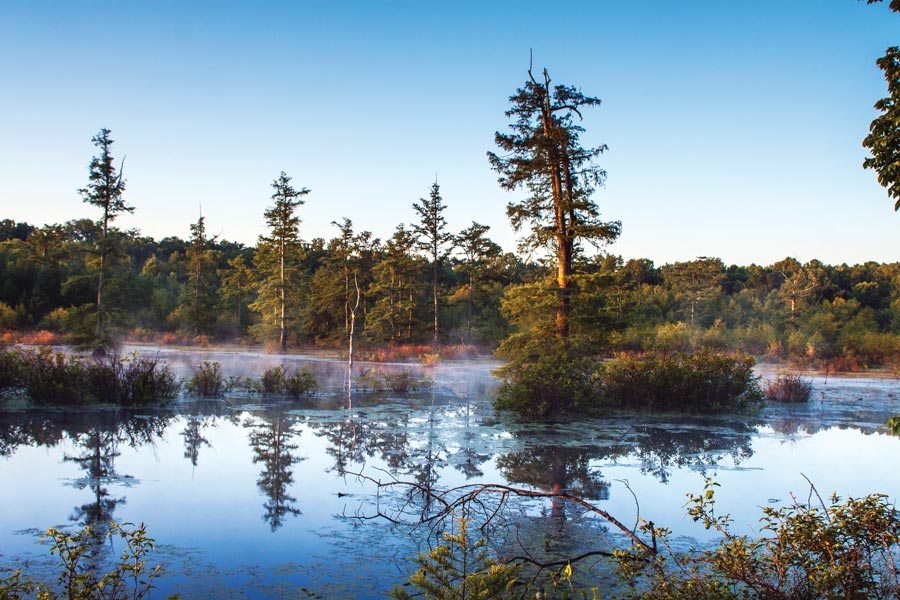
The landscape of Crowley’s Ridge cannot hide as it cuts across the Bootheel’s instep. This unusual geologic phenomenon towers an average 200 feet above the surrounding flat farmland along 42 Missouri miles of designated National Scenic Byway. The ridge is visible from Mingo National Wildlife Refuge and just about everywhere else.
Mingo preserves a part of the old swamp and features a surprisingly accessible glimpse into a vibrant ecosystem with all of its critters. Migrating waterfowl appreciate the courtesy of this preserve, and they reward visitors with up-close views of their habits and habitat.
The visitor center presents the single most awesome display I’ve ever seen anywhere in my life. Walking through the front door, I saw two buck deer, giant antlers locked together so their snouts are inches from each other. Their ritual territorial fight had changed into a fight for survival when they realized they were hopelessly locked together. They were found in the swamp, where they drowned when they couldn’t cooperate for a drink of water.
“We wish more people knew about this place,” a ranger told me. I agreed. This preserve shows what the land looked like more than a century ago, before what may be the most dramatic transformation of swampland to farmland in North America. The engineers of this massive drainage feat included teams fresh from dredging the Panama Canal.
Before the swamp was drained, the Bootheel area provided great cover for animals large and small. Clear-cutting and a complex network of drainage canals have left precious little cover among the cotton fields and rice paddies and the occasional shrimp farm. Yet there is still one more preserved swamp in the Bootheel at Big Oak Tree State Park.
I assumed the centerpiece of Big Oak Tree State Park was a big oak tree. Well … it used to be. Back in 1937, when the state acquired the land, the big oak tree was the alpha tree among the other giants. Even then, it was 481 rings old, meaning it germinated in 1456.
This thousand-acre forest is Mother Nature’s secret recipe for greatness, blending swamp and soil so fertile that a remarkable variety of trees grow to steroidal proportions. Fact is, six state champion trees have towered over the park, including two national champs. Now, sadly, that roster doesn’t include the big oak tree. A few years back, it bit the dust. But I found a cross section of the mighty oak at the visitor center.
By far the most common visitors to Big Oak Tree are birds. More than 150 different species, some rare, have clutched a branch in the rarified air, dropping an occasional present onto what might be Missouri’s longest boardwalk. The park makes a great rest area along the Mississippi flyway. With a treetop canopy reaching 140 feet, there’s plenty of room in the high-rise and an unobstructed view for miles and miles.

Beavers Get Their Due
My car and I drove across the Castor River, and crossed the Castor River again and again and again and again. We crossed the Castor River so many times that I stopped to study my map. The map shows two Castor Rivers, at one point flowing within five miles of each other. Apparently, when they drained all this swampland, one Castor River became two.
Castor is French for beaver, and the beavers built dams all through this swampy region. Despite their reputation as the hardest working hydraulic engineers on the planet, beavers don’t get a paycheck, so they have a right to be the namesake of multiple waterways.
The beavers must’ve been disappointed when engineers turned the lower Castor River into a drainage canal, sucking precious swamp water away.
Henry Schoolcraft, the first chronicler of the Ozarks, had another name for the Castor. He called it Crooked Creek. It’s a simple name. One can understand why he preferred simple names. His wife’s name was Obabaamwewegiizhigokwe, which in her native Ojibwa language means “the sound that the stars make as they rush across the sky.” Henry called her Jane, which means “Jane.” I think I know why. Her mother, Ozhaguscodaywayquay, probably didn’t object, since she herself adopted the Anglo name Susan Johnston.
Lake Wappapello
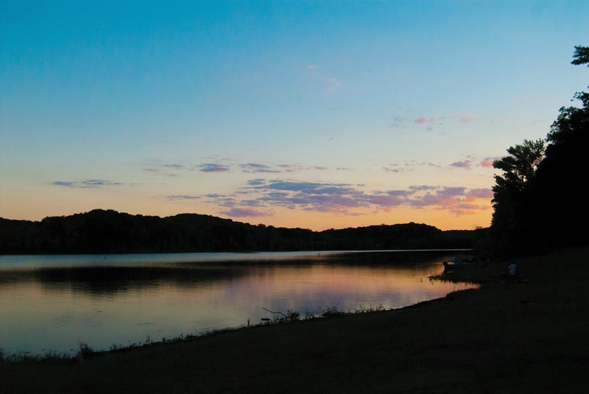
If you wanted to hide from hit men or creditors, Lake Wappapello would do nicely. Isolated in rugged hills, wholly surrounded by the thick woods of Mark Twain National Forest, the lake stands apart from the crowd. Literally. The nearest three towns—Williamsville, Wappapello, and the Wayne County seat of Greenville—combine to fall short of a population of 900 and dropping. Local fishermen hope it stays that way—less competition for fish.
Selling Sin
In an area that has been economically depressed since the shoe factories shut down and moved overseas a generation ago, Missouri holds one big advantage over neighboring Arkansas: the powerful economic benefit of sin.
Many Arkansas counties still ban the sale of liquor, a virtue Missouri counties abandoned around the same time Pat Nixon’s husband abdicated the throne to Betty Ford’s husband. Latching onto the rim of this massive Arkansan dearth of spirits, Missouri entrepreneurs sit like vultures, just a bunt away from the Arkansas line.
An archipelago of liquor stores stretches across Missouri’s south border, along the most unlikely outpost roads, amid cotton fields and nothing else. There, capitalism takes root, with prime commercial frontage along the battle lines of sin. Fagus is one such outpost, sitting on the map like the head of a cobbler’s nail in the instep of the Bootheel. It used to be a timber town, until they cut down all the trees. The entire zip code that surrounds this little town shows only 31 people.
Yet the town’s solitary industry thrives. Stores perched on Missouri’s borders sit like 80-proof ATMs to service the needs of Arkansan back-door Baptists who drive 60 feet into Missouri to buy enough hooch to wet their whistles. They come from neighboring Piggot and Rector and Corning. “They used to not sell lottery tickets, either,” said the young woman who rang the cash register at Robison & McIver Gro. and Pkg. about her good Arkansas neighbors. “But now they do.” So that cut into her business. No matter. John Barleycorn still provides a good living, down here in the land of cotton and the mindset of Cotton Mather.
Strawberry’s
Dunklin is Missouri’s tallest county, standing almost 44 miles from its sole to its crown. It’s shaped like the left side of an hourglass, and it’s stuffed mostly with cotton. Near the tiny waistline of this corseted county sits Holcomb. And Strawberry’s Bar-B-Que.
I went south through Peach Orchard and White Oak, around the horn into Holcomb, to rediscover what I still believe to be the best smoked ribs in the Milky Way Galaxy. Strawberry’s Mid- Town Dining Room serves excellent slawburgers and fried green beans. But folks come for the ribs. A large rib plate will set you back nearly 15 bucks and send you back home wondering why other smokers even bother.
Finding out about Strawberry’s for the first time was a barbecue epiphany. Several years ago, just outside Puxico at the Mingo National Wildlife Refuge welcome center, a crowd had assembled to discuss agritourism. When it was my turn to speak, I tried to flatter the locals. “When Americans talk about barbecue, they mention Kansas City,” I offered. “But I know where to find the best barbecue in Missouri. It’s right here in Stoddard County, down the road in Dexter.” As soon as I mentioned two of my longtime favorite southeast Missouri barbecue stops—Hickory Log and Dexter Bar-B-Que—folks started squirming and shaking their heads, flailing their arms and shouting “Strawberry’s!” I was puzzled, not knowing what strawberries had to do with barbecue. The crowd kept chanting, “Strawberry’s … Strawberry’s.”
I bit. “Strawberries?”
“In Holcomb … in Holcomb,” they chanted. Next day was my first Strawberry’s, a dark cozy bit of rustic where the table menus double as yellow pages, with ads for car parts, funeral homes, bail bonds, and real estate, if memory serves me. That was just window dressing. When that slab of ribs came, I didn’t read another word. Indeed, the slabs at Strawberry’s are so tender, the meat falls off the bone from the vibrations of your voice. The sauce stands up to any Kansas City masterpiece, and if you want dry ribs Memphis-style, Strawberry’s rivals the legendary Rendezvous near Beale Street.
Buster Brown
Down near the border, just three miles from Arkansas, I uncovered an icon from my childhood. Southwest of Hornersville, down a dirt road, a cemetery holds the remains of Buster Brown. Most kids who grew up wearing Buster Brown shoes probably thought Buster himself was a kid. Not so. He was born William H. Ray at the beginning of the Civil War, and he stopped growing when he reached 44 inches tall. He made a living as a circus performer known as Major Ray until he retired to Hornersville and opened a general store where he not only sold Buster Brown shoes, but he also convinced the Brown Shoe Company in 1900 to make him spokesman. At 40 years old, Major Ray became Buster Brown. He died in 1936, and sometime thereafter folks erected a tombstone with his likeness, dressed as Buster Brown. He’s a memory now, same as the empty shoe factories that dot the Bootheel landscape.
The Bluff
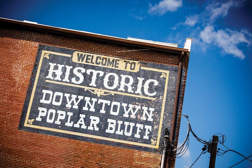
They call it The Bluff for short. Poplar Bluff was founded as a timber town, served by a succession of major railroads such as the Missouri Pacific, Frisco, and Iron Mountain, and smaller railroads such as the Current River Railroad, the Cairo Arkansas Texas Railroad, and the Butler County Railroad. The poplars in the town’s name refer to the magnolia of the north, the yellow tulip trees commonly known as poplars that grew on the hills overlooking the Black River. It’s the home of America’s first patented adding machine. The adding machine company left before World War I, and a shoe factory moved into the building. Now the shoe factory is gone, too, along with every other shoe factory in the entire region. When the shoe factory shut down, folks had to scramble for jobs.
But it’s not the first time Poplar Bluff reincarnated. Local records show that shortly before the Civil War, residents tried to raise money to build a courthouse by selling swampland at a dollar an acre. Buying swampland might not have seemed like a good investment at the time, but it paid off handsomely a half century later when the Inter-River Drainage District began to drain the swamps. In the meantime, hungry railroads had cut all the area’s pine forests, and by the end of World War I, harvesters had depleted the hardwoods, too. So the lumber industry pretty much died out, and King Cotton took hold in the rich soil exposed by the drained swamps. Less than a decade later, the 1927 tornado tore through town, killing at least a hundred people and razing much of downtown.
Earlier in the day at a Poplar Bluff McDonald’s, I overheard a man telling people at the next table: “I have eight kids at home. No TV. I tell them: read. They don’t like it, but that’s why they read at a college level.” I hoped they read about their town’s tumultuous history. He opened his laptop and ate his McBreakfast. I almost intruded into their conversation, volunteering that I just came from a wilderness campsite, with fewer amenities than his family, and I still struggle to read at a college level. I kept silent, though, and headed back into the wilderness, with no TV. It is refreshing to sequester myself from the electronic trappings of modern civilization.
Then my cell phone rang.

Where Cotton is King
The old cotton gin at Pascola looks abandoned, but a flatbed wagon in back betrays cotton balls stuck in its cage. The gin is a giant on the flat landscape, a sprawling, rusted two-story tin shed. But come the harvest, contraptions like this one spring to life, digesting enough cotton seeds to panel your basement.
Missouri ranks eighth in US cotton production—all of it grown in five Bootheel counties.
I’ve heard stories about the rigors of picking cotton, but never in the excruciating detail described by a friend who offered a first-hand account.
“As a kid, it’s one of the first things I remember,” Bob recalled. Children have one advantage: they don’t have to bend over as far to pull cotton off the scrubby plants. “We were dirt poor, and the cotton harvest was one of the biggest opportunities to make some money to buy food and shoes. Mom had us kids out in the fields at dawn with our gunny sacks, ready to start pulling cotton bolls off the plants. Mom was smart. On the first day, she told us kids, ‘I’ll give you two cents a pound.’ We picked like crazy, and she paid us at sundown. Next day, we were up early again, ready to go, and she said, ‘Now, you must pick as much as you did yesterday.’ She didn’t pay us for that.”
Life’s lessons are hard.
Related Posts
7 Missouri Waterfalls
A haven for gorgeous scenery, the Ozarks is brimming with stunning waterfalls. April and May are great months to enjoy our waterfalls, as water flow is at its peak from spring showers.
Pickleball Is Taking Missouri By Storm
It took about a decade for pickleball to sweep Missouri. With more than 100 locations developed since 2010, Missouri might just have the fastest-growing pickleball community in the country.
Paddling 340 Miles on the Missouri River
From August 8 to 11, 450 crazy people will paddle down the Missouri River in canoes, in kayaks, and stand-up paddleboats—all competing against each other and themselves in the MR340 race.

