In the seventeenth century when France had an empire in the interior of North America, there was a large region in the center of the continent known to the French as Le pays des Illinois, “The Illinois Country.” It was a deferential nod to those whose country it was, the dozen or so American Indian tribes of the Illinois Confederation who occupied this vast region that encompassed most of the middle Mississippi valley from Iowa to Arkansas, including eastern Missouri, and up the Ohio River to Indiana.
Of course, “Illinois” is a transcription by early French explorers of a Native American term; today, we know a more nearly correct spelling is “Iliniwek.” This Algonquin-related word was used by other Indians to refer to the allied tribes of the Confederation. The meaning of the word “Iliniwek” was that the members of those tribes all spoke a common language that was mutually understood, but the word that the Iliniwek used to refer to themselves was “Inoka,” most likely meaning “the people.”
Explorers of the interior rarely encountered native peoples who did not already know about Europeans. In addition to trading goods, natives traded information among their tribes, and both goods and information moved westward well ahead of European people. The first European awareness of the Iliniwek began when other American Indians visiting the Jesuit missions on the Great Lakes told the French about the Iliniwek, and then when the Iliniwek themselves made the journey to the missions and even to Quebec. At the Chequamegon mission, a thousand miles from Quebec at the far west end of Lake Superior, Father Jacques Marquette was particularly stirred by the stories he heard from visiting Iliniwek, stories of a great river, “Missisipi” (Marquette’s spelling), and of large Iliniwek villages along it, one of which more than three centuries later would become Iliniwek Village State Historic Site in far northeast Missouri. How Father Marquette and his companion Louis Jolliet (also spelled Joliet) came to be visitors in this large Indian village near the mouth of the Des Moines River is one of the great exploration stories of North America.

In Quebec, Gov. Louis de Buade, comte de Frontenac also had an interest in this “great river” because it suggested a possible opportunity. Since finding North America, Europeans had been frustrated in not finding a way around it or through it for a quick route to India and the Far East. It had finally become apparent that there was no passage northwest from Quebec through the ice, but some wondered if the great river flowing south could be a southwest passage to India. Could this river possibly empty into the Gulf of California? There was only one way to find out: the governor selected the young adventurer Louis Jolliet to lead an expedition, in company with Father Marquette and a crew of five voyageurs in two canoes. Marquette and Jolliet made a good pair: it was said that Jolliet “had the courage to dread nothing in a place where everything was to be feared,” while Father Marquette had knowledge from the people of the Iliniwek country and could speak their language, despite having never been there.
On the morning of May 17, 1673, Marquette, Jolliet, and their companions left the mission of St. Ignace at the Straits of Mackinac in Michigan and headed southwest, Father Marquette in hope of harvesting Iliniwek souls and Jolliet in search of glory—or at the very least, value for his king and country. They proceeded down Lake Michigan to Green Bay, up the Fox River to a portage, then had to carry their canoes several miles to enter the Wisconsin River. A month later on June 17, they entered into the “Missisipi” near present-day Prairie du Chien with, as Marquette put it, “a joy I cannot express.” The Iliniwek visiting his mission had been exactly right about the great river.
On June 25, 1673, while traveling down the Mississippi, they saw a path made by humans along the riverbank near the mouth of a tributary. Leaving their canoes and crew behind, Marquette and Jolliet cautiously followed the path alone on foot. A half-dozen miles inland from the Mississippi along the channel of the Des Moines River, they learned who had made the path—and quite a lot more. Before them lay a village, actually a complex of three villages, with a total of some three hundred dwellings and several thousand Indians. This was an Iliniwek village, more specifically, that of the Peoria, one of the larger tribes in the Iliniwek Confederation. The explorers stood in cautious surprise, watching the village scene until a group of four elderly men walked out to them, bringing the calumet, or peace pipe, in welcome.
After exploring the villages and participating in numerous ceremonies for several days, Marquette and Jolliet took leave of the Peoria, primed with new knowledge of the country and a peace calumet for safe passage, to continue their voyage south where they would eventually learn that the Mississippi River doesn’t flow into the Pacific Ocean. When they left the Peoria village, six hundred of the villagers walked with them back down the path to the Mississippi, where their canoes and five voyageurs awaited them. Marquette promised to return the following year and found a mission for the Iliniwek—and he did, at one of their villages on the Illinois River.

For the next three hundred years, no one knew where this Peoria village had been. Then in 1984 a routine archaeological survey for a rural waterline found it, not in Iowa as had been thought, but in Clark County, Missouri. Archaeologists also found a Jesuit ring and Iliniwek artifacts. So among their other accomplishments, Marquette and Jolliet became the first Europeans to tread the ground of what eventually became the state of Missouri. In 1992 the site of the village they visited became a new unit of the Missouri state park system.
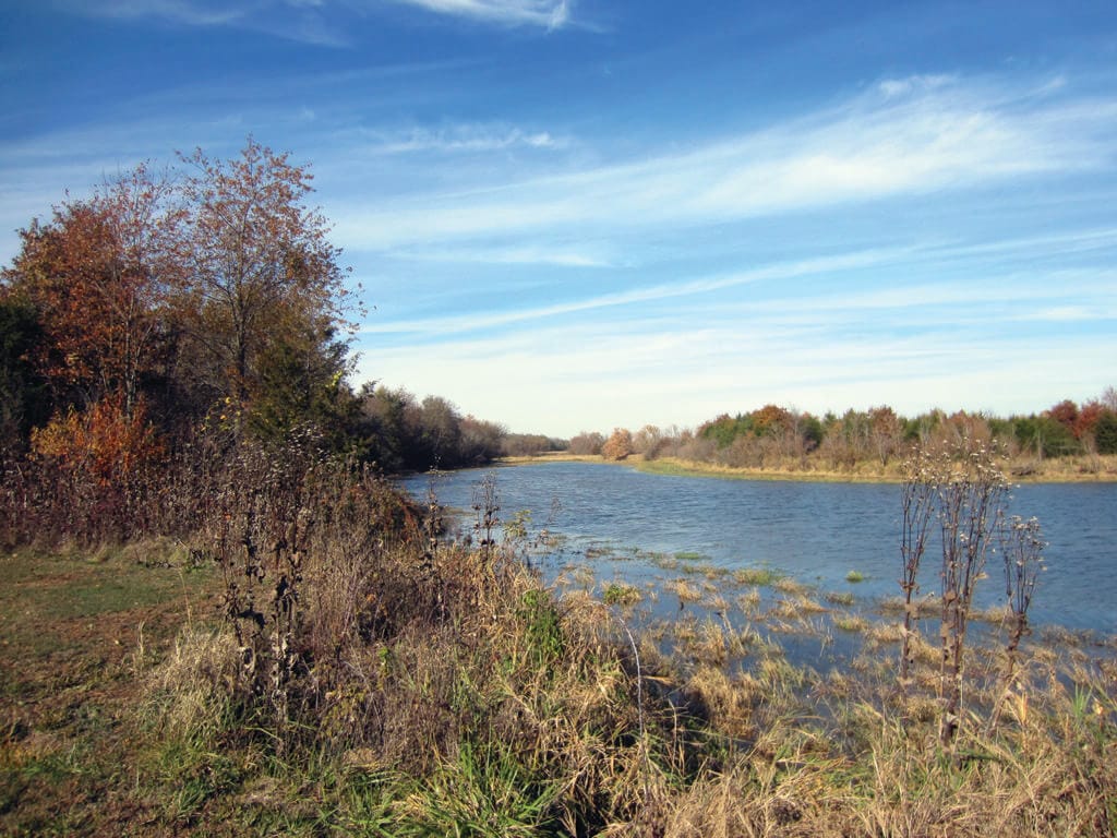
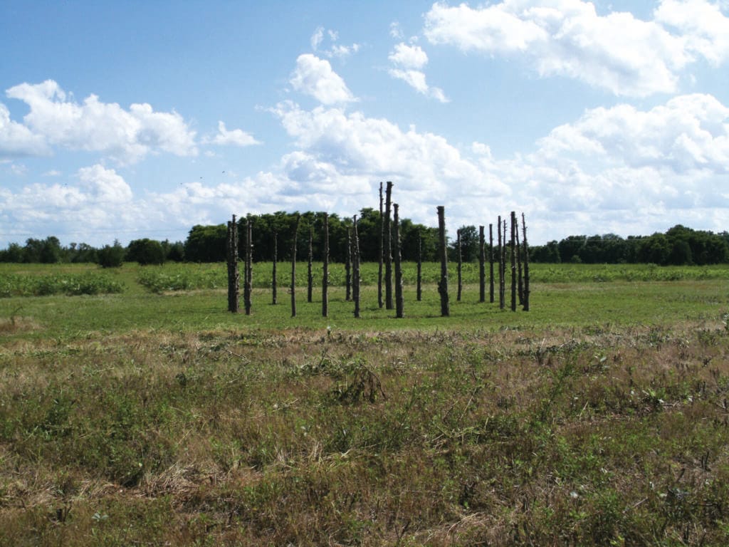
Today, the historic site offers tables for picnics, a kiosk featuring attractive graphic panels explaining the Iliniwek, their way of life at the village, and interesting information about the unusual plants and animals that live here, as well as a short trail. Most of the 127-acre site is flat and grass covered—prairie that is being seeded and otherwise managed to encourage the return of the native plant cover. The only concentrated woody vegetation is a strip of trees and brush lining the edge of a slough and oxbow lake, with individual trees scattered sparsely over the landscape, including the ones park managers have left for shade in the picnic area and along the trail. Altogether there is a mile and a half of trail, leading to several areas where archaeological excavations have taken place and to the oxbow lake. The trail has a surface of packed fine gravel as far as the archaeological zone. There, visitors may see the outline on the ground of one of the Iliniwek longhouses. As archaeologists uncovered the traces of the original side posts of the house, new posts were installed into the old postholes, resulting in a physical outline of the house on the ground. On the return loop is a similarly ghosted example of one of the round houses. The oxbow lake and slough, which in 1673 was part of the river, provides views of migratory waterfowl in season and a better sense of this landscape as a prairie component of a riparian corridor.

The valley of the Des Moines River is more modest than that of the Mississippi but is still sizable, about two and a half miles in width at the Iliniwek Village site. The valley floor is nearly flat, with low terraces intertwined with many still visible extinct river channels, marshy areas, and small oxbow lakes in the process of shrinking into sloughs. This landscape bears unmistakable evidence of the Des Moines having meandered repeatedly back and forth from highland to highland in fairly recent geologic times, filling the valley with sandy soil and gravel, a gift from ancient glaciers.
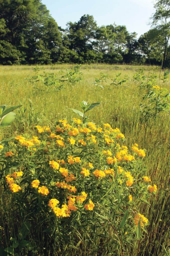
When Father Marquette said the trail he was following to the village opened into “a pretty prairie,” he was quite correct, but he couldn’t know how special a prairie it would become, at least in Missouri. It was a sand prairie, distinguished by plants and animals adapted to living in a sandy environment and now a rare type of natural community in Missouri. Today, most of the sand prairie in the state, including on the Des Moines River terraces, has been plowed under and turned to cropland. But here and there on scattered small tracts, some of the sand prairie species have survived, and Iliniwek Village State Historic Site is one of those tracts. Within the bounds of the historic site are a number of species of rare sand-adapted plants. The site also hosts several species of native bees whose only known occurrence in the state is here. Thus, the acquisition of this important historic property has also provided the park system with another example of a rare natural community. This combination of natural and cultural resources on the same property requires park system scientists to maintain a careful balance in management techniques so that both archaeological and natural resources are protected, and to insure that a strategy that enhances one does not harm the other.
When the explorers first arrived at the Peoria village, the “Great Captain” had greeted them in this fashion: “I thank thee, Black Gown [Marquette], and thee, O frenchman [Jolliet] for having taken so much trouble to come to visit us. Never has the earth been so beautiful, or the sun so Bright as today. … Never has our tobacco tasted so good, or our corn appeared so fine, as We now see Them.” Perhaps if the chief had been able to see the future, he wouldn’t have been so pleased to see his French guests. The future yielded less pleasant dealings with Europeans. In fact, the Iliniwek were here on the west bank of the Mississippi in the first place because European incursion on the East Coast had already forced Native Americans to the west by the 1600s. The Iliniwek were in conflict with these eastern tribes pushing into their territory, while to the west Siouan tribes and the Missouria and the Osage were pushing back in the other direction. The Iliniwek were in a squeeze, and to make matters worse, their friendly relationship with Europeans exposed them to measles and smallpox. The constant warfare with their new neighbors decimated some of the Iliniwek tribes, and whole villages were wiped out by Old World diseases, to which American Indians had no immunity. Scholars estimate there were once more than twelve thousand Iliniwek, but by the early 1800s, they had declined to only a few hundred.
The five major tribes of the Iliniwek Confederation—Peoria, Cahokia, Kaskaskia, Tamaroa, and Michigamea—acted together as a confederation for the last time at the signing of the Treaty of Edwardsville in 1818. By further treaty in 1832, they gave up their claim to all Iliniwek lands in Illinois and Missouri. Today, the Iliniwek Village State Historic Site is a reminder of the vagaries of history and of a time when our part of the world was once part of someone else’s world, Le pays des Illinois. *
*LIFE IN AN ILINIWEK VILLAGE: The Iliniwek people were semi-agriculturalists, concentrating in these large villages in the spring to work the ground and plant their crops, primarily Indian corn or maize, along with beans and squash. These foods were supplemented with gathered natural plant foods and hunted game animals. Once the crops were well established in early summer, most of the villagers departed west on a summer hunt, mainly for bison, and did not return until the crops planted earlier were ready for harvest and storage at the end of summer. Then in late fall, the village broke up into smaller groups that scattered farther afield to enhance their success in hunting small game in the winter landscape. In the spring, they returned to the village to begin the cycle over again, reoccupying the permanent structures. Of these, the most impressive were the longhouses, large enough for several families to occupy, being some sixty feet long and twenty feet wide, built of side posts bent to join overhead in the middle and covered with woven rush matting. A variety of other structures of different shapes and sizes fulfilled other needs of the villagers. The string of dwellings and the several village centers stretched for more than a mile and a half along the Des Moines River.
ILINIWEK VILLAGE STATE HISTORIC SITE • ROUTE 26, WAYLAND
To read more, purchase the Missouri State Parks and Historic Sites book here


