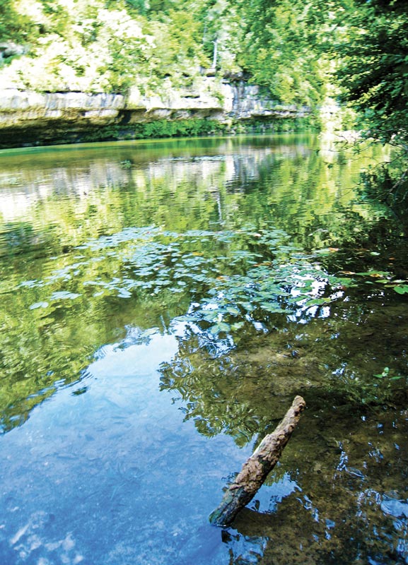
Parks and trails lace Missouri like cracks in cobblestone, places where you can escape from urban life and commune with nature among windswept glades and shady forests. It’s a wild world from sweeping vistas atop Bell Mountain to waters of the Eleven Point River flowing into the early morning mist. As inviting as the whip-poor-will’s call in the dark, Missouri’s wilderness beckons exploration.
Nature lovers who frequent the many state parks here inevitably find their way to one of Missouri’s eight national wilderness areas. Spanning more than 71,000 acres, these primitive areas have minimal signage and sometimes unclear paths, but that’s part of the fun. All the same, a map and compass make wise additions to your hiking gear.
Congress designated these large tracts of southern Missouri lands as wilderness areas last century. The federal Wilderness Act of 1964 describes wilderness as a place “… where the earth and its community of life are untrammeled (not confined or limited) by man; where man himself is a visitor who does not remain.” To visit a wilderness is to experience the land the way the settlers did, exploring a heritage preserved in these natural time capsules. So pack your lunch and step off your porch—we’re going into the wild.
The Irish Wilderness
At 16,277 acres, this is Missouri’s largest wilderness area. The area takes its name from a long-gone settlement of the 19th century. In the 1840s, St. Louis was an unfriendly place for Irish Catholics, so a priest led roughly 40 Irish families away from the city and into the Oregon County wilderness to establish an idyllic community far from intolerance. Contact with the settlement was lost at the onset of the Civil War and by war’s end, no one was living there. It is assumed they died at the hands of marauders and deserters who used the area as a safe haven. Even today, this 150-year-old mystery covers the area like a shroud.
Now a part of the Mark Twain National Forest, the Irish Wilderness landscape differs from what those early wanderers encountered. When walking through the forest, imagine the stately virgin white oaks that once grew here, oaks famously so large their circumferences necessitated measurement in feet. Those trees were harvested along with the rest in the Ozark logging boom of the early 20th century. The current growth is a mixture of oak, hickory, and shortleaf pine. Grasslands and idyllic Ozark glades also typify the area.
The 19.6-mile loop of the Whites Creek Trail guides hikers along the Eleven Point River and through curiously named hollows such as Bliss, Orchard, and Barn Hollow. Hiking the trail affords an opportunity to see the Whites Creek Cave, which serves as a home for the endangered Indiana bat. Gorgeous springs of all sizes punctuate the area and inundate the Eleven Point, where reintroduced otters frolic among water plants and overhanging roots. The smaller Bliss and Fiddlers Springs are a short quarter-mile distance off the main trail with signs indicating their presence. The shock of these cold springs brings respite to hikers and backpackers during the summer months.
“… the earth and its community of life are untrammeled (not confined or limited) by man; where man himself is a visitor who does not remain …” —Wilderness Act of 1964
 Bell Mountain Wilderness
Bell Mountain formed along with the rest of Iron County’s St. Francois Mountains about 1.4 billion years ago, bursting forth from the explosive action of three volcanos. The range is one of the oldest land masses in North America by far (in contrast, the Rocky Mountains formed a scant 140 million years ago). These mountaintops formed one of the only island chains in a near endless sea, evidenced by the lack of sea fossils on their peaks.
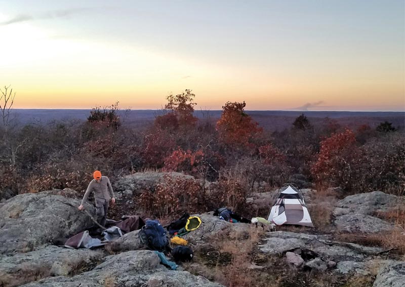
Hikers summiting the ancient peak are rewarded with one of the more scenic camping locations in the state. Named for a family that once lived and farmed on the ridge top, Bell Mountain is hobbled in appearance and bent with age as if battered by time. Granite boulders strewn about the summit sustain a glade ecosystem resembling a rocky English moor.
The 12-mile loop is accessible from the north with a side entrance to the west. Long-distance hikers on the Ozark Trail come through the area when it merges with the loop near the southwestern corner. Joes Creek meanders through the western half of the 9,143-acre wilderness. During hunting season, you may come across deer and hog hunters on the trail.
There are no active springs near the trail and only a few still-water ponds and perennial streams; hikers should bring water on this difficult trek that undergoes an elevation change of 732 feet. The top of the mountain is a mere 70 feet lower than the highest point in Missouri, and the Taum Sauk Hydroelectric Power Station on nearby Proffit Mountain sits in plain view.
Hikers who master the summit and return to their cars find themselves a short distance from Johnson’s Shut-Ins and Elephant Rocks State Parks, two well-known destinations.
Devils Backbone Wilderness
Diverse tracks of white-tailed deer, raccoons, red and gray foxes, bobcats, and striped skunks cross the trails of the 6,687-acre Devils Backbone Wilderness. Although those are interesting, hikers who keep their eyes on the ground may miss out on seeing various birds soaring overhead, including bald eagles, great blue herons, and red-tailed hawks.
The 13 miles of moderate trails following the Devils Backbone “spine” were named by settlers for its vertebrae-like ridges. The McGarr trail leads through limestone glades where copperhead and eastern timber rattlers hunt for field mice. The trail continues through forests of oak, sweetgum, and sugar maple that flare in brilliant oranges, yellows, and reds in the fall. Hikers on the trail will experience a vigorous altitude climb of 340 feet.
The area boasts three large springs that feed into the North Fork of the White River—the McGarr, Amber, and Blue Springs all contribute to the river. Blue Spring alone gushes 7 million gallons every day.
This Ozark County wilderness sees only light use and is a great resource for backpackers looking for overnight camping, when great horned owls and coyotes call through the darkness.
Hercules Glades Wilderness
The peaceful and somber forest of Hercules Glades stretches over 12,413 acres in Taney County and contains a great example of a glade ecosystem. Hiking the glades affords opportunity to see animals more associated with the deserts of the American Southwest such as roadrunners, tarantulas, collared lizards, and rattlesnakes. The rocky soil of the glades supports desertlike plants well adapted to thrive in the harsh environment. Explorers will see flowers such as coneflowers, purple prairie clover, prairie dock, primrose, blazing star, and black-eyed Susans. Lucky hikers may encounter trees more than 300 years old. These trees are the old men of the glade. Growing conditions are so tough, they grow slowly and are typically broader and gnarlier than their lowland cousins.
Hercules Glades has something for everyone. The area is near Branson, and Long Creek Falls in the western portion of the wilderness is a popular destination for visitors with its refreshing, photogenic swimming hole. Hikers who enjoy solitude will find the 32 miles of trails lightly used. Trails here have steep terrain and stream crossings, making for difficult conditions. Most visitors choose to hike either the western or eastern portion with most favoring the western loop. This wilderness is dominated by perennial streams. Rangers advise visitors to carry extra water during dry spells.
Rockpile Mountain Wilderness
A circle of granite rests like an ancient crown atop the highest point of Missouri’s smallest wilderness area. The 4,238-acre Rockpile Mountain earned a congressional wilderness designation relatively recently, in 1980. The rock formation is believed to be the remnants of a cairn erected by Native Americans. The 2-mile trail system suffered damage during the 2009 super derecho windstorm that caused many trees to fall and obscure the trail. Day hikers and campers seeking out the namesake rock pile will find substantial Forest Service improvements to the area since 2009. The best way in is via Rockpile Mountain trailhead, located in Madison County at the end of Forest Road 2124 near the top of adjacent Little Grass Mountain. The last mile of the road can be rough, so hikers without four-wheel-drive vehicles will have to leave their cars and hike to the trailhead from that point.
Several miles of nonsystem routes exist in the area, but Chris Woods, an incident commander with the US Forest Service, advises visitors to stick with the trail. “Each year, officials search for lost visitors who use the nonsystem trails,” he says. Chris recommends bringing a topographic map and a compass so as to stay on the proper trail.
Paddy Creek Wilderness
This new forest near Rolla was once a goldmine for loggers. Visitors interested in the history of the Ozarks can clearly see the effects of the logging industry in Texas County. The area was virgin forest until the early 1800s when entrepreneur Sylvester Paddy began felling the stately oaks. The timber played a big role in the building of St. Louis. When the trees were cleared, the area transformed into large grazing pastures. Designated as a wilderness in 1983, 7,035-acre Paddy Creek still retains small fields among the hickories and shortleaf pine, a remnant of its pastoral past. Now hikers—not cattle—wander the woodland. Deer, coyotes, bobcats, and foxes are also common.
The Big Paddy and Little Paddy Creeks lend their character to the area with steep cliffs and rocky outcrops along their beds.
Piney Creek Wilderness
Nestled on a northern branch of Table Rock Lake, Piney Creek is within easy distance of Springfield and Branson. Roughly 13 miles of trails crisscross the 8,178 acres of sycamore, ash, walnut, elm, buckeye, and other native Ozark hardwoods. Backpackers can cool their feet in the numerous small springs dotting the landscape that join together to feed several creeks.
Ridge tops loom 400 feet above shadowed hollows that once were home to settlers cultivating the rich soils. The last inhabitants left the area in the 1950s. These deserted farms were once known for their strawberries and tomatoes but now only support trees and sightseers.
Light usage means hikers will enjoy a measure of quietude when meandering through this water-rich area that straddles Barry and Stone Counties. Be alert for copperheads, eastern timber rattlers, and the short and squat western pygmy rattlesnakes. Not all wildlife here is serpentine; the great blue herons of Table Rock keep their rookeries nearby and cruise the skies close to the water. Armadillos and other animals common in the Ozarks also reside here and are frequent sights.
Mingo National Wildlife Refuge and Wilderness
This wilderness area contains a lesson for all Missourians on the irreplaceable role it plays for more than 245 species of birds and migratory waterfowl. Today its ecosystem is a treasure of ecology to biologists and nature enthusiasts, but the area was not always appreciated. Before Congress designated the refuge in 1964 and then the wilderness in 1976, the area had been drained, burned, tortured, and trashed to near annihilation. Through careful restoration efforts this 21,592-acre refuge—the last of this once-massive wetland that covered most of the Bootheel—has been preserved and restored. The wilderness, at 7,730 acres, accounts for a third of the refuge.
This fall, when the rest of southern Missouri turns to bright oranges and shimmering yellows, the leaves of the coniferous bald cypress trees of Mingo will flare red before falling to coat the surface of the water. Fall is also a time when otter lovers should visit the refuge. The sleek creatures are most active in autumn.
Hikers who balk at the prospect of wading through a marsh teeming with fungal life can use the handicap-accessible 1-mile boardwalk located in the refuge or one of the five boat ramps accessible at different parts of the wilderness and refuge. Canoeing and boating are permissible in most areas and are the best ways to interact with the wetlands. Fishing the wetlands is a favorite pastime of locals and visitors alike.
Know Before You Go
When visiting any wilderness, be aware of proper wilderness etiquette. Some of these ecosystems can be delicate places, easily harmed by invasive species such as the emerald ash borer. Various restrictions apply to each wilderness.
To prepare for your visit, check out these websites:
Mark Twain National Forest: FS.USDA.gov/mtnf (click tab for Special Places)
Mingo National Wildlife Refuge and Wilderness: FWS.gov/refuge/mingo
Wilderness Connect: Wilderness.net/wild
Hikers who enjoy solitude will be at home among the rugged peaks and peaceful glades of Missouri’s wilderness where quiet hours are from 10 pm to 6 am. Armed with location-specific knowledge, you’ll be ready to head out like a fox looking back once more before disappearing into the undergrowth.
Photos by Evan Henningsen
Article originally published in the March/April 2019 issue of Missouri Life.
Related Posts
National Antique Tractor Pull
Old tractors. Pulling weights. Pack up Grandma and Grandpa and anyone else who might remember some of these old tractors on the farm. Actually, youngsters enjoy this event, too, and some competitors are quite young.
First National FFA Convention
November 20, 1928 was the very first National FFA Convention was held in Kansas City.
STATE-TISTICS: Conservation Areas in Missouri
Conservation areas by the numbers


