
I’ve always considered hiking one of the best ways to exercise, mainly because it doesn’t feel like work and there’s no timer reminding you that you’ve only been running for five minutes and forty-six seconds, like on a treadmill. I enjoy hikes especially during fall when the temperatures are cooler and you can hike on most days.
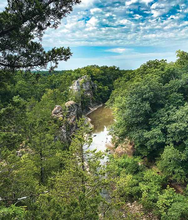
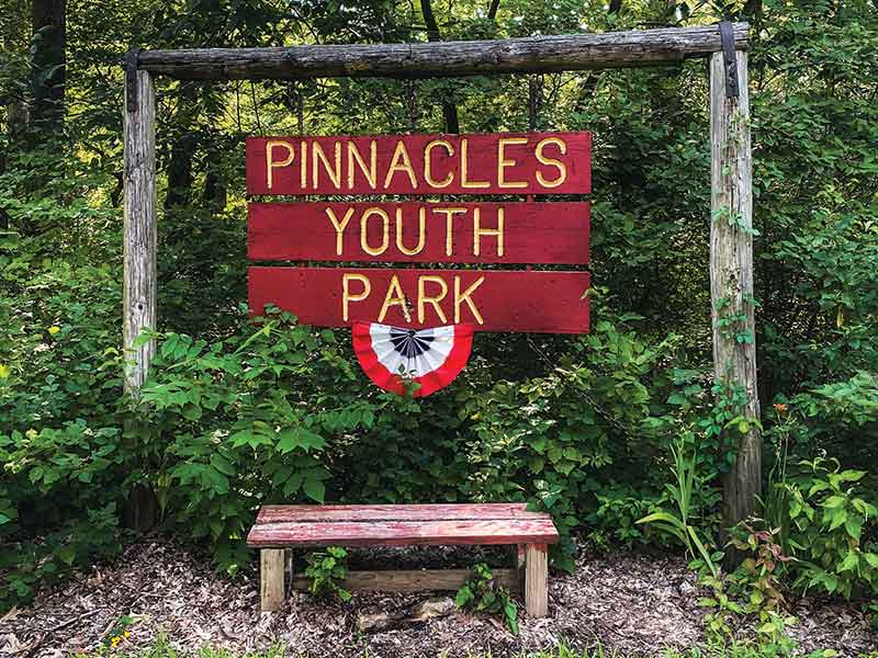
On a Sunday morning, I decided to go for a hike since there was a slight breeze and I had been cooped up in my small apartment for days on end. I headed to Sturgeon, just fourteen miles north of Columbia, to hike at the Pinnacles Youth Park, also known simply as The Pinnacles. This private park is managed by the Boone County Pinnacles Youth Foundation, but it is open and free to the public. Here, you can find and hike on top of 250-million-year-old limestone rock formations that were once under water during the time when all of Boone County was.
I arrived around 9 AM. Below the pinnacles, Kelley Branch Creek and Silver Fork Creek intersect. Sometimes when the water is high enough, you’ll see people cooling off or relaxing in inner tubes. Frequently, small children are wading in the shallow streams. Luckily for me, it wasn’t too high at the area I had to walk over. I used stepping stones to cross, reminding myself to avoid the ones covered in algae so I wouldn’t slip in the water early on and have wet socks the rest of the hike.
Once I made it across, it was just a slight hike up before I started to see the amazing rock formations up close and personal. The pinnacles are 75-feet high, stretch 1,000-feet long, and are a sight to see in mid-Missouri. This might not be the best hike for someone afraid of heights, but the view from above is hard to match. I made sure I didn’t get too close to the edge. When you’re that high up, it feels like a strong gust of wind could push you over.
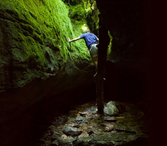
I took a couple of breaks inside the natural archways where there was shade and on some of the tallest boulders to feel the breeze. It’s not the easiest hike in Missouri since there are some narrow spots to navigate, but that wasn’t often. I pulled myself up into some of the nooks and crannies to explore. I saw a couple of hikers with dogs who were managing just fine.
When I got to the end of the rock formations—or beginning depending on which way you decide to enter—I was met with a dirt trail that took me through the woods. After a couple of wrong turns, I ended up at a very steep hill full of rocks, trees, and mud. I figured this had to be the way out, so I started trekking down. It had rained the day before, so it was a pretty slippery journey, but I managed to make it down without mishap. At the bottom of the hill, a piece of wood with a heart shape followed by “Attack Hill” is nailed to a tree. Looking from bottom to top, I was pretty happy that I ended up going down the Heart Attack Hill rather than up. After that, there was a short hike out of the woods, across a manmade wooden bridge, and onto East Pinnacles Road.
850 East Pinnacles Road, Sturgeon
Related Posts

Columbia Cherishes its Past
Columbia always has an eye on its future, but it cherishes the stories of its past. You can get an in-person glimpse of history at these Columbia locales.
Nature-bathing in Columbia
You can get away without going far when you explore the trails of Columbia.