
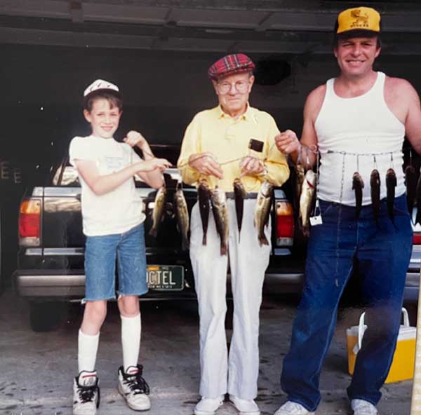
Bennett Spring State Park is well-known among anglers for its excellent trout fishing, but visitors also enjoy its hiking trails, Niangua River access, campgrounds, cabins, and meals served in the park’s rustic 1930s dining lodge.

Photo by Pat Whalen
Approaching from Route 64 west of Lebanon, Missouri, you wind down an entrance road past several private cottages and a tackle shop, then emerge from the upland into the hill-cradled valley of Bennett Spring. Across the manicured valley floor, you see the racing, tree-lined stream, almost always host to attentive figures garbed in waders and other accouterments of the devout angler. They stroke the waters lovingly with their lines and, with rods extended, twitch the tips from time to time—homage to the sacred trout.
Wooded slopes rise steeply on either flank, home to a diverse array of songbirds and other wildlife. On your right, you pass a sandstone buttressed nature center, and the road curves over the stream on a graceful bridge of concrete and native stone, a now historic structure built in 1934 by the Civilian Conservation Corps (CCC). Upstream to your left is a low dam, successor to earlier milldams, usually lined with anglers—literally shoulder to shoulder at season’s opening and on pleasant weekends. Nearby are the brown buildings of the fish hatchery where the rainbow trout are spawned and nurtured. The hatchlings are rotated by age groups in a network of artificially fed ponds, and some are grown to lunker size before being released into the stream for enticement by anglers’ lures.

Photo by Scott Myers
Over the bridge, you enter the village-like heart of the park. The lodge, containing a restaurant and meeting room, is another architectural gem from CCC days, its decorative chandeliers featuring a trout motif. In the park store, the concessionaire sells tackle and other supplies to visitors and rents cabins and canoes for use on the nearby Niangua River; there is also a classroom for fishing instruction. Past these buildings, one road winds around the hill to stone cabins of modern construction and a few renovated ones built in the CCC years. The main park road extends downstream along the riffles and pools of the spring branch, recrosses it via a low bridge near the point where it empties into the Niangua River, then goes back up the hill and rejoins the main highway. Along this route through the park, you will also pass a swimming pool, campsites with electric hookups, and a spur road that leads to more campgrounds, including sites for tent campers and less mechanized vacationers.
Without spending a thoughtful hour or two studying the old photographs, maps, and artifacts in the nature center, you could scarcely imagine how this inviting and popular park evolved from a little mill town. The town faded away when big companies in Minneapolis and Kansas City began cheaply producing and distributing flour and other cereal products and when the automobile and improved roads led residents of the area into Lebanon or Buffalo to do their shopping. But the great spring has been a constant in the history of the area, and the rainbow trout became a catalyst for change. The same roads that once led toward bigger towns with more goods and services now enable hundreds of thousands of visitors to come to this appealing valley for recreation.
This was once territory of the Osage Indians and earlier native peoples, whose legends suggest a special reverence for the spring. The Osage had already ceded their lands in Missouri when an early settler named James Brice arrived with his wife and their two young daughters around 1837. Originally from Virginia, Brice recognized an economic opportunity in the strong and steady flow from the spring. Even before obtaining his first land patent, Brice erected a small gristmill on the spring branch, likely near the spring, about one-and-a-half miles upstream from its confluence with the Niangua River. He secured his first deed for 121 acres in Dallas County—a parcel that included the spring and part of the spring branch—from the federal government on December 11, 1846. In later purchases from the government and from a neighbor, Brice increased his holdings to 427 acres straddling the Dallas-Laclede county line.
Peter Bennett and his son soon established another mill downstream on the Niangua from the confluence. Both mills were swept away by floods in 1852. Brice began a new mill about a half mile downstream from the spring but died a year later, bequeathing his land and mill to his daughter Anna, who later married Peter Bennett Jr., entwining the two families.
In those days, the spring was known as Brice Spring, and the town that grew by the mill was called Brice. During the Civil War, according to old newspaper files, Peter Bennett Jr. constructed a larger, three-story mill on the spring branch with a timber dam and millrace. This family operated the mill until it burned in 1895 in what was rumored to be arson. The local Atchley family leased the land from the Bennetts and built the last in the historic succession of mills at Brice in 1900.
It was during the period from about 1900 until the Great Depression, according to regional historians, that Brice enjoyed its greatest prosperity. The focus of the area began to shift toward recreation after trout were introduced in 1900. The town had not only the mill but also a hotel and a store—both owned and operated by the Bennetts—a blacksmith shop, a church, and perhaps a second general store. In addition to farmers who came to get their grain milled and to shop in the general store, tourists began to arrive in buggies and later in Model Ts and Model As to stay at the Brice Inn and enjoy fishing and relaxing in the scenic valley.
The popular name of the spring had long since changed from Brice to Bennett, but the settlement was called Brice until its demise after it was bought by the state for a park in 1925. The last mill ceased making flour and cornmeal sometime in the 1920s but continued to grind food for fish and to generate electricity until it, too, was destroyed by fire in 1944. The church still stands in the park on one acre donated by the Bennetts in 1917 and remains an active place of worship for the community. It was veneered with locally quarried orange-brown sandstone in 1940 to blend with CCC-built structures.
The trout that brought prosperity to the town and later to the park apparently came initially from a federal fish hatchery at Neosho, Missouri. The Laclede County Sentinel reported in January 1900 that the state fish commissioner “stopped by ” and released forty thousand mountain trout. Although unrecorded, there were probably other releases of trout before Charles Furrow, a dentist and fishing enthusiast from Tulsa, Oklahoma, leased a site along the spring branch from the Bennetts and built a fish hatchery in 1924.The hatchery at Neosho provided fifty thousand rainbow trout eggs for Furrow’s new hatchery troughs and placed another fifty thousand brook trout eggs from Wisconsin into the stream.
Bennett Spring was one of the first state parks acquired by State Game and Fish Commissioner Frank H. Wielandy with funds set aside under a legislative act from hunting and fishing license revenues. The initial acquisitions included eight acres from Josephine Bennett Smith in 1924 and 565 acres in 1925 from William Sherman Bennett, who had added to the acres that his parents inherited from James Brice. The state also acquired Dr. Furrow’s hatchery, which was operated until 1937 by the Game and Fish Department and after that by its successor agency, the Missouri Department of Conservation.
Little improvement took place in the new state park after its purchase until a CCC company composed of nearly two hundred out-of-work veterans of World War I arrived on the scene in November 1933. During the next four years, according to a CCC yearbook, the vets built “an $8,000 dam, a $13,000 bridge, a $14,000 dining lodge, six beautiful cabins, a store and post office building, shelter houses, roads, and trails.” They also renovated the Atchley mill, enlarged the fish hatchery, and built a custodian’s residence, as well as a stonemasonry latrine and rustic trailside benches. In addition, they razed and carted away the now dilapidated and deserted buildings of the old town of Brice. Most of the CCC structures still grace the park, many of them on the National Register of Historic Places.
The State Park Board administered land, facilities, and operations in the park, except for the hatchery, until 1974 when its successor agency, the Park Division of the Missouri Department of Natural Resources, took over. The Department of Conservation still operates the hatchery, licenses anglers, sets limits, seasons, and fishing hours, and enforces regulations. The daily release of catchable trout is based on the number of trout tags sold, so anglers are always assured of a well-stocked stream.
After the initial acquisitions in 1924 and 1925, the state continued to pick up adjacent tracts as they became available, and by early 1988, the total stood at just over 1,400 acres. This included the 160-acre Bennett Spring Savanna, located several miles south of the park along Route OO, an outstanding natural feature leased to the state by the Nature Conservancy in 1984 as one of the best examples known of a historic native Ozark open oak woodland.

Photo by Diane Tucker
Then a breakthrough: in 1988, the park division bought 1,660 acres from three willing sellers, adding native woodlands and glades that include most of the watershed of Spring Hollow extending southeast from the spring. Dye-trace studies in the late 1980s delineated a nearly 300-square-mile area south and east of the spring, including the city of Lebanon, that provides recharge to the spring, making Spring Hollow important for watershed and water quality protection. The acquisition more than doubled the opportunities for hiking and added significant natural history features, including a natural tunnel one hundred yards long, several shallow caves used for shelter by Native Americans and more recent huntsmen, and a spring-fed pond. On the uplands are substantial remnants of high quality open oak woodlands similar to those on the Nature Conservancy land, which has also since been enlarged to 920 acres, now contiguous with the park. Both park and Nature Conservancy lands are being restored and maintained by their respective staffs with the use of prescribed fire.
The Natural Tunnel and Savanna Ridge Trails, totaling some ten miles with several loops, provide access to Spring Hollow and its associated woodlands seasonally abloom with wildflowers. Part of the trail goes through a twisting valley with steep cliffs, which are actually remainders of a collapsed cave system; the natural tunnel carved through the dolomite strata by the stream over geologic ages is in fact a cave, one that has been cut off by erosion of deeper valleys at each end. Inside, the tunnel is forty to fifty feet wide in places with a ceiling up to sixteen feet high. Even during the driest times of the year, spring-fed pools within the tunnel are populated by small fish and other aquatic organisms. These cave remnants are connected to a much more extensive underground labyrinth that feeds the great spring at Bennett.

Photo by Paul Nelson
At the spring, visitors are fascinated by the powerful surge of water that issues mysteriously from the earth. A wayside exhibit profiles the depths of the spring, explored by qualified scuba divers who have descended more than a hundred feet into its cave-like passage that often contains trout and native crayfish. At the bottom, a torrential spring flow erupts through a narrow cleft at the base of a dolomite wall, its passage largely unexplored because the current is too swift. Here, nature performs her own polishing of rock jewelry, tumbling small pieces of chert in the upward-rushing currents, resulting in smoothly rounded stones.
You can learn more about a natural Ozark cold-water spring at the nature center, where staff can answer most questions. An illuminated plastic bubble in the center simulates spring water with its microcosmic underwater universe, its algae and insects magnified two hundred times to enhance understanding of the beginnings of the food chains that feed the larger animals we can see. Invisible to the human eye but around the legs of every angler wading in the stream is a fascinating array of brilliantly colored water mites, daphnias, and other creatures that drift among colonies of algae.
Exhibits also explain how the fractured layers of soluble limestone and dolomite in the region’s natural plumbing system capture surface water not only from natural rainfall but also from garden sprinklers and septic tanks. An understanding of this process helps citizens of nearby Lebanon to appreciate the importance of protecting the area’s water quality to ensure the continued health of Bennett Spring.
The one-and-a-half-mile branch from the springhead to the Niangua River has been altered in places by damming for mill purposes, by dredging to create deep holes for trout, and by both natural and man-induced changes in stream-side and emergent vegetation, but certain stream segments are left as natural riffle zones to preserve the aquatic plants and animals native to the cold-water spring branch.
In 1982, the Missouri Natural Areas Committee designated a small area of five acres on a series of dolomite ledges on the steep hillside along the spring branch as the Bennett Spring Hanging Fen Natural Area, which is saturated by seeps of cool, calcareous groundwater that allow unusual fen plants to thrive. It may be viewed from the Spring Trail on the west side of the branch, which takes you from the spring past a CCC-era stone gauge house to the hatchery area. The straight and geometric concrete races for trout are of course entirely human artifacts, but the swarms of rainbow trout, all swimming in place against the constant current, are fascinating to watch.

Photo courtesy of Missouri State Parks
Anglers and their families predominate among the more than 700,00 visitors at Bennett annually, but many others come to relax in the dining lodge, cabins, and campgrounds, to float the Niangua River, or to hike the trails through the scenic woodlands, awash in dogwood blooms each April. Everyone who comes, though, senses that the park is here because of the spring. And so are the trout.
Feature image photo by Nick Decker.
BENNETT SPRING STATE PARK • 26250 ROUTE 64A, LEBANON

Related Posts

Bennett Spring State Park Has More Than Great Fishing
Bennett Spring State Park is lovely at any time of year, but visiting in the Fall is glorious. The lodge is a rustic yet very comfortable place to stay for a few days, so you have plenty of time to take in all this State Park has to offer.

Bennett Spring State Park, a Haven for Folks Who Fish
The largest spring in the state, rainbow trout, a nature center, and a lodge with a restaurant are just a few of the fabulous things you will find at Bennett Spring State Park. Pack up the car and spend a weekend exploring this park.

A Trout Fishing Adventure at Montauk
Matt Crossman takes us along for the adventure when he and his buddies go trout fishing at Montauk State Park. The river is cold and there are a few mishaps, but the reward is a delicious fish dinner around the campfire at the end of the day.
Fishing memories: Perfection on the water
“Fishing’s not just about catching, it’s about getting out and enjoying the outdoors. Catching fish is a bonus.” Granddad had many sayings like these that helped form a foundation that directly influenced my path in life. I’ve often wondered who—or what—would’ve come of me without that influence so early on. Fishing and life are one in the same if you asked me. The lessons learned on the water most definitely last a lifetime.