
Table Rock State Park is indeed worth a visit. It provides the perfect access to a storied region. You may enjoy the abundant tourist attractions of Branson, but when you need a break, you can hike the park trails or find along some backwoods byways much that is still unspoiled and inviting in the White River Hills.

THE GEOGRAPHIC REGION KNOWN AS THE OZARKS has various definitions, depending upon one’s point of view. There is a generalized area that most people can agree is the Ozarks, but the geologist, botanist, and historian always seem to draw the outer boundaries differently, and they differ also about where the true heart of the area lies. From a cultural point of view, many would argue that the heart of the Ozarks, the cultural core if you will, would be in the upper White River valley, straddling the border between Missouri and Arkansas.
This valley is physically near the center of almost anyone’s definition of the Ozarks—except the geologist, who would look to the oldest rocks in the St. Francois Mountains. The people who settled the White River country were relatively homogeneous, at least in comparison to Ozark border areas. The White River settlers were old-stock Americans primarily from the southern Appalachians. They were migrants from the same rugged country that Horace Kephart described in his classic study, Our Southern Highlanders. These folk dominated most of the Ozark region, and in the White River valley, the highland stock was nearly undiluted.
In addition to its ethnic character, the valley’s geography has encouraged a sense of region. The White River blithely ignored state boundaries, and to some extent the settlers saw themselves as White River valley residents—not in place of but at least in addition to being Missourians or Arkansans. This is one Ozark area where people readily identify themselves as Ozarkians.
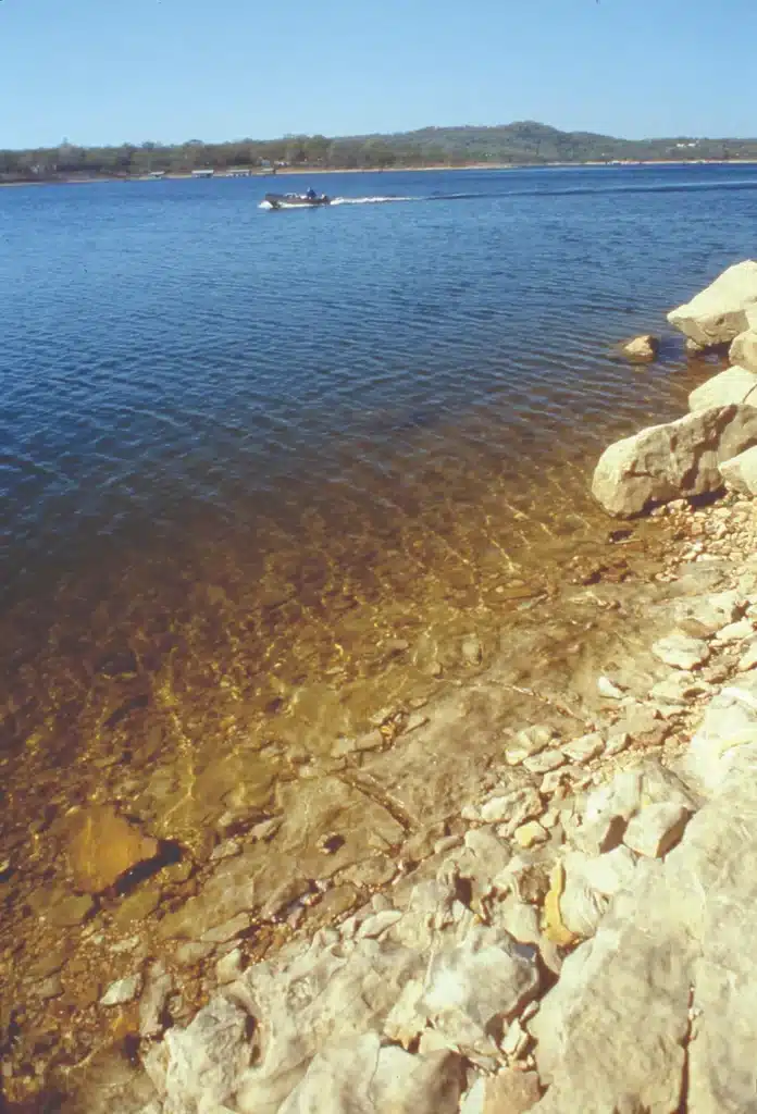
Photo by Tom Nagel
This sense of regional identity was further established by several literary works. One of the first of the literate explorers of the Ozarks was Henry Rowe Schoolcraft, who traversed the region on horseback in 1818 and 1819 and was enamored of the area. The writer Harold Bell Wright in 1907 produced a romantic and enormously popular novel, Shepherd of the Hills, set in the White River country, which for good or ill shaped the image of the people of the Ozarks for the national public and, eventually, the self-image of Ozarkians themselves, in part. It was seekers of Wright’s Ozarkian fantasy who constituted the first wave of tourism into the White River country. In fact, the centerpiece of Wright’s tale, Old Matt’s Cabin, was located only a few miles from where Table Rock State Park would be established a half-century later. A more academic but often amusing look at Ozark culture was provided by Vance Randolph, who spent years collecting the music, stories, and traditions of the Ozarks, focusing a lion’s share of his attention on the White River country.
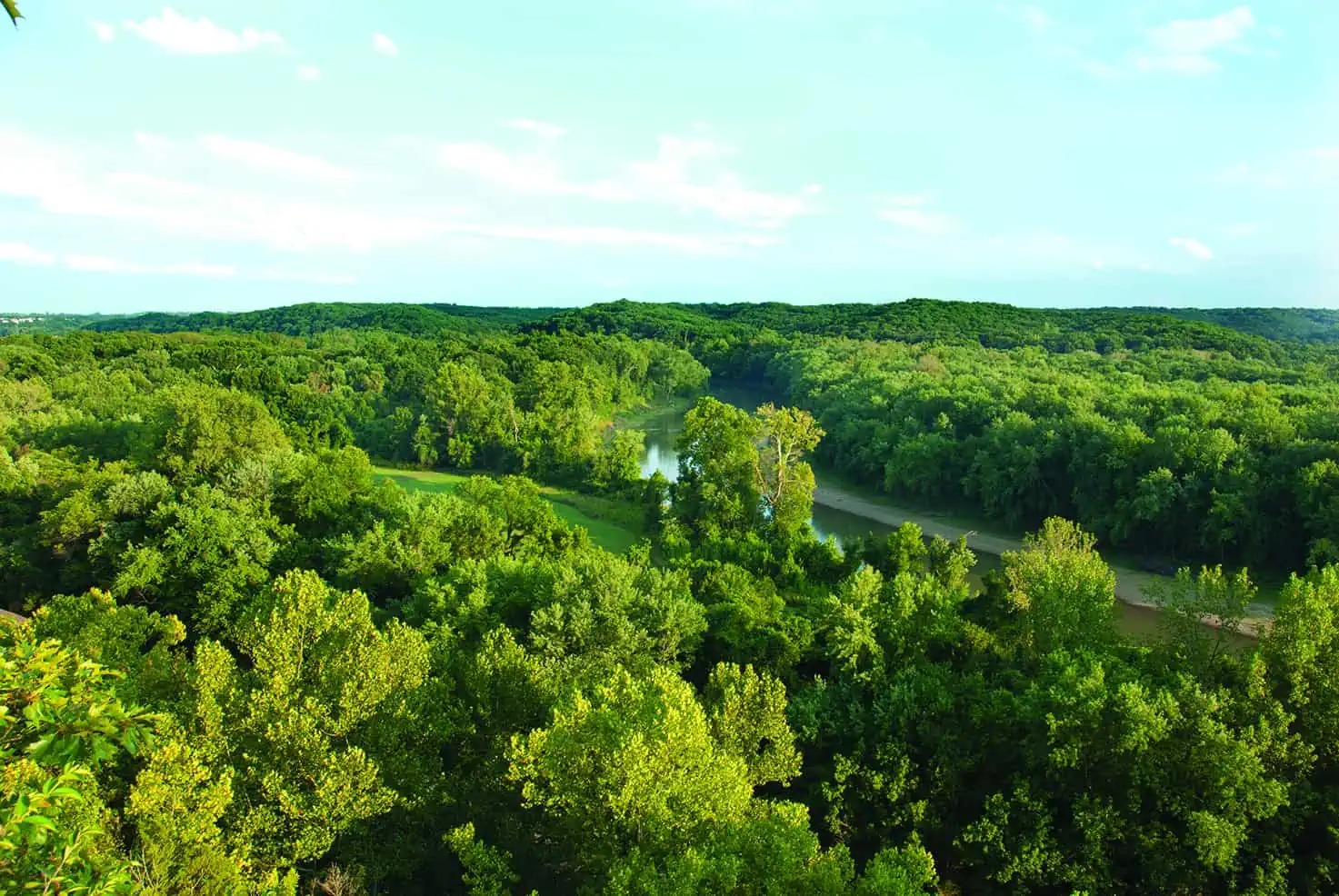
The White River is long and sinuous, originating in northern Arkansas, flowing north into Missouri, then south back into Arkansas, with several loops back into Missouri, finally leaving Missouri for good, and then sliding out of the hills and through the lowlands of eastern Arkansas to join the Mississippi River. The upper valley is generally the region near the state line, embracing the whole length of the river in Missouri plus some of the major tributary valleys, including all or parts of Barry, Stone, Taney, Christian, Douglas, and Ozark counties.
The promise of power and the peril of flooding eventually drowned the White River. The first dam on the White was Powersite, constructed in 1912 and creating Lake Taneycomo. It was Missouri’s first hydroelectric dam, and it is still owned by Empire District Electric Company. Later, the Army Corps of Engineers, under the authorization of the Flood Control Acts of 1938 and 1941, constructed four more major dams in the upper White River valley: Norfork, Bull Shoals, Table Rock, and Beaver. Because of these reservoirs, not a single mile of the original White River still flows free in Missouri. The headwaters of some of its tributaries are all that are left of this once great river system.
At 252 feet, Table Rock Dam in Taney County is by far the highest dam in the state, and it is the only one of these four corps dams constructed within the boundaries of Missouri. Opposition to the dam was fierce, but a powerful combination of utility and Chamber of Commerce interests prevailed, and the 43,000-acre hydroelectric and flood-control reservoir was completed in 1959. The dam and lake take their name from a high rock shelf along the White River just downstream from the dam.
The construction of Table Rock and other corps lakes in Missouri provided an opportunity for the Missouri State Park Board to acquire several state parks at little or no cost in the 1950s and 1960s when there were no funds available for acquisition of new state parks. These lake parks provided a different sort of recreation than most of the existing state parks from earlier eras, featuring large acreages of flat water perfect for every aspect of boating or water sport. At Table Rock State Park, the 1957 leasehold from the Corps of Engineers consists of about 350 acres along the northeast shore of the lake near the dam, about eight miles south of Branson. The park provides a full array of lake-oriented facilities, including camping and picnic areas amid the oaks and hickories along the winding lakeshore, a boat launch, and the largest full-service marina in the state park system. Visitors can rent a kayak or a ski boat, try a para-sailing ride, take an excursion on a catamaran, get trained and outfitted for scuba diving, or even rent a bike.

Photo by Carl Bonnel
For those who enjoy their recreation on solid ground, tiny Table Rock park offers access to more than fifteen miles of trails in addition to its lakeshore camping and picnicking facilities. The Chinquapin Trail provides a taste of Ozark woodlands and glades for people walking from one part of the developed area to the other, while the Lakeshore Trail is a paved hiking and biking trail that follows the shoreline from the park marina to the Corps of Engineers Visitor Center at the Table Rock Dam two miles to the north. Like the Lakeshore Trail, the twelve-mile White River Valley Trail uses corps as well as state land and offers a fair sampling of rugged White River woodlands and glades. This hiking and mountain-biking trail, which consists of four interconnected loops, was awarded national Coalition for Recreational Trails honors upon its completion in 2011. The park has some of the best glades in the Branson area and is one of the few places in the park system where one can find the showy American smoke tree, a signature species of the White River Hills. It also has a small area of riverfront forest with the eye-catching yellowwood, another signature species, and a canebrake where the rare Swainson’s warbler has been spotted.
Table Rock Lake, for all the controversy that attended its birth, is a beautiful body of water. It is known for the stunning clarity of its waters, a fact that scuba divers will attest. The fishing is excellent, especially for bass and, in nearby Lake Taneycomo, for trout stocked by the Department of Conservation’s Shepherd of the Hills Hatchery close to the park. And of course, it is a favorite for swimming, boating, and water-skiing.
The lake has suffered serious water quality problems at times, due to all the development in its watershed coupled with leakage from septic systems, agricultural runoff, and the city of Springfield twenty-five miles to the north. But to their credit, civic organizations and citizens of southwest Missouri recognized the threat this posed to their tourism-based economy and have become strong supporters of measures to greatly improve Springfield’s sewage-treatment system and to reduce pollution and runoff.
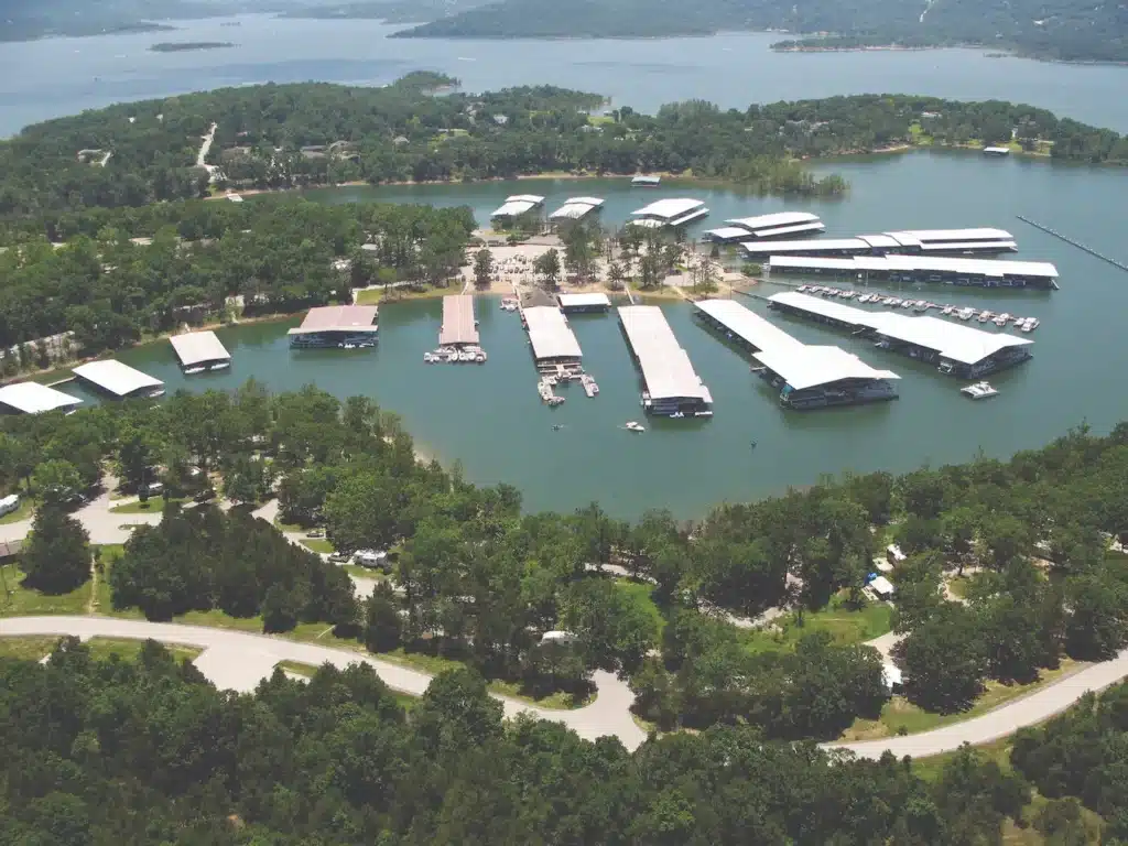
Photo Courtesy of Missouri State Parks
Construction of these large lakes spurred the boom in tourism that had begun on a smaller scale with Lake Taneycomo in the 1920s. You can rent a boat at the largest marina in the park system and then enjoy the crystal waters, rocky shores, and glade-dotted hills. Because the park is next to Branson, chances are you will hear some country music. All Missouri State Parks new roads for access and the attraction of the lake, plus the allure of the scenic hills and the Ozark mystique, Forsyth, Branson, and other area communities underwent revolutionary change. The Herschend family leased Marvel Cave, a show cave in Branson, in 1950 and developed the Ozark-themed Silver Dollar City to complement it, beginning in 1960. Shortly thereafter, Presley’s Country Jubilee became the first of what within forty years would be more than one hundred country music and other theaters in Branson, making it a national destination for live music and other entertainment.

Photo Courtesy of Missouri State Parks
No longer an isolated region, the White River country became instead a fringe of the Sun Belt and faced a new invasion from the North, this time of tourists, vacationers, and retirees. Harold Bell Wright came to the “Shepherd of the Hills Country” by taking the train to the end of the tracks and then proceeding on horseback. Modern pilgrims will find their way there on a new four-lane highway that would have made a highway engineer’s jaw drop only a few years ago. Mountains have been cleft, valleys filled, and a concrete ribbon now leads like an arrow to the heart of this tourist mecca.
The intensity of the industrial-scale tourism around Branson must be seen to be believed. For miles along certain roadways, there are wall-to-wall attractions ranging from miniature golf emporiums and fast-food franchises to country music palaces. Needless to say, much of the original culture of the valley has been displaced. Ironically, a commercialized version of rustic Ozark culture serves as a chief theme of the local tourist industry. If real Ozarkians are now scarce, numerous imitations, some in fair earnest, are nevertheless offered in abundance. “Hillbillies,” some in neon and some in genuine homespun, are all over the place in Ozark Mountain Country.
Nestled in the midst of all the bustle lies Table Rock State Park. Admittedly, many visitors to the park are attracted by abundant entertainment in the vicinity. But that they appreciate what the park itself has to offer may be indicated by ballots cast in 2010 by readers of the AAA Midwest Traveler magazine, who voted Table Rock the best park in the Midwest by a nearly two-to-one margin. (The second and third place winners were also Missouri state parks, Lake of the Ozarks and Ha Ha Tonka.)

Photo Courtesy of Missouri State Parks
This small 350-acre park annually attracts more than a million visitors from all over Missouri and throughout the country, more than any other state park except the largest, 17,600-acre Lake of the Ozarks State Park, many times the size of Table Rock.

TABLE ROCK STATE PARK • 5272 ROUTE 165, BRANSON
Order Missouri State Parks and Historic Sites book here.
Related Posts
Castlewood State Park
Castlewood State Park has more than thirty miles of hiking and biking trails, eleven of which are open to horseback riders. Experience the feel of a mature floodplain forest with its silver maple, box elder, black willow, white ash, sycamore, slippery elm, and hackberry. Bring a picnic and enjoy the beauty of this park.

Big Lake State Park, a Place to Relax and Enjoy Nature
Spend a few days at Big lake State Park. There is so much to do from fishing to camping to boating. Big Lake is an oxbow lake and among the largest remaining natural oxbow lakes along the Missouri River. It is one of the largest natural lakes of any type in the State.

Get Out and Enjoy the Katy Trail State Park!
What was once the MKT (Missouri-Kansas-Texas) railroad,The Katy Trail State Park has so much to explore on foot, by bike, or on some stretches, horseback. The trail runs 240 miles over 14 counties. Get out and see the state in a whole new way.