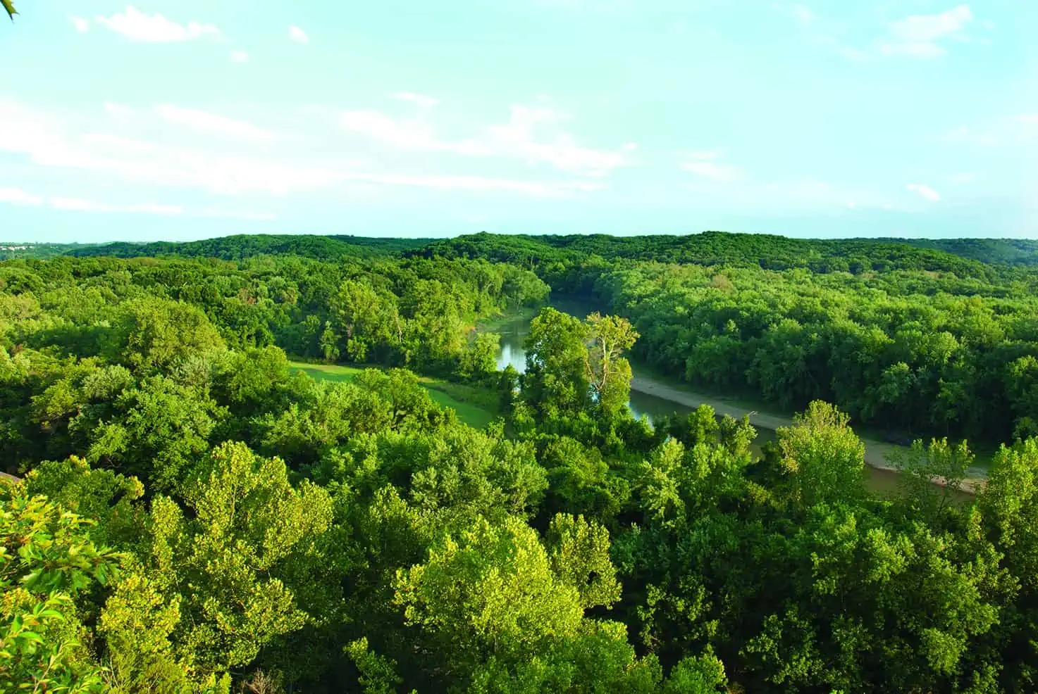
Long Branch State Park has one of the nicest sandy beaches of any state park as well as amazing walleye fishing. Spend the day hiking the park and learn all about its extraordinary history. And find out all about the Bee Trace.
IN THE EARLY 1800s, pioneers from the Appalachian hills and valleys of North Carolina and Kentucky followed Daniel Boone into Missouri, and some of them continued on into the area north of the Missouri River. Traveling westward along the Salt River, a Mississippi River tributary, or northward from the Missouri River via the Chariton River, they converged on an ancient American Indian trade route that followed high ground marking the geographical divide between the Mississippi and Missouri drainages, known as the Grand Divide. Thus, they found the land that is now Randolph, Macon, and Adair counties, and it reminded them of home. Skilled woodsmen and farmers settled first in the timbered valleys of the rivers and creeks, felling logs to build houses and barns and clearing the bottomlands for crops.
In 1965, Congress authorized a dam, a multipurpose project for flood control, water supply, and recreation for the area. The Army Corps of Engineers actually constructed the dam on the East Fork Little Chariton, a few miles south of the point where the waters of Long Branch joined its flow, but in the annals of federal public works it was Long Branch Dam. The 2,450-acre reservoir it formed is Long Branch Lake, and the park in Macon County is Long Branch State Park, which surrounds the lower reaches of the reservoir.

After the dam was completed in 1980, the corps leased 550 acres of the shoreline area to Missouri for a state park. The federal agency also signed an agreement with the Missouri Department of Natural Resources to share equally the cost of developing and operating recreational facilities. Among the facilities are picnic areas, campgrounds, a swimming beach, several boat ramps, and a marina.
In 1987 the state park grew to more than 1,800 acres by lease of additional corps land. The new acreage includes the southern part of the historic Bee Trace area between the two arms of the reservoir and addi- tional lands on the eastern side, the so-called Macon area. The dam and park lie just north of Highway 36, scarcely west of Macon.
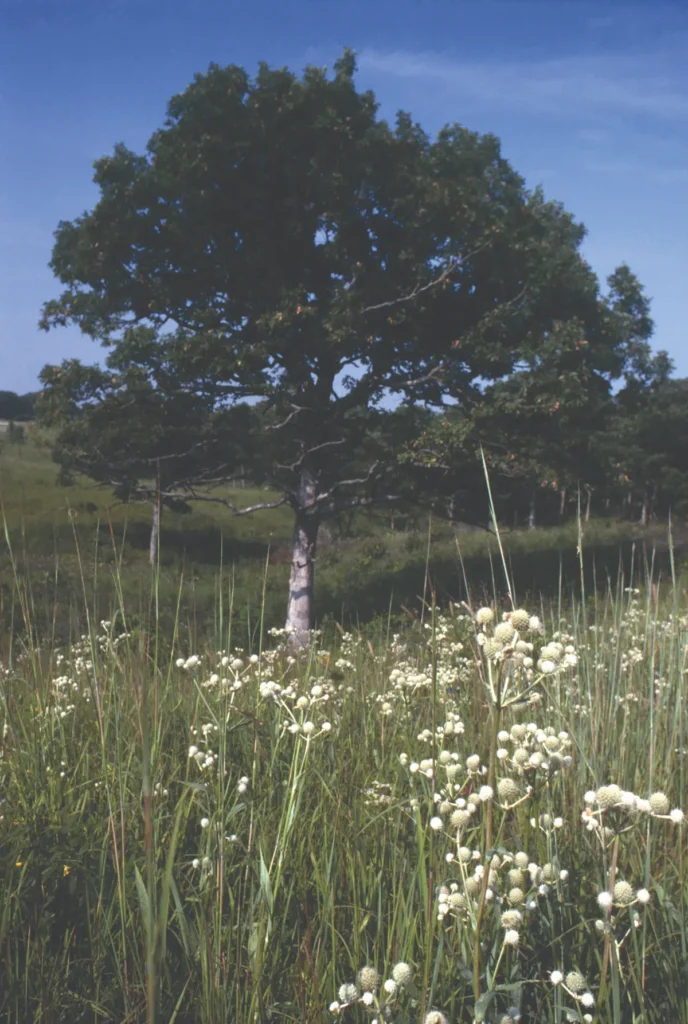
Photo by Ken McCarty
Some 640 acres of the Bee Trace area, where settlers harvested honey, lie within the park. The area is mostly open woodland interspersed with native prairie, a once common savanna landscape now rare in
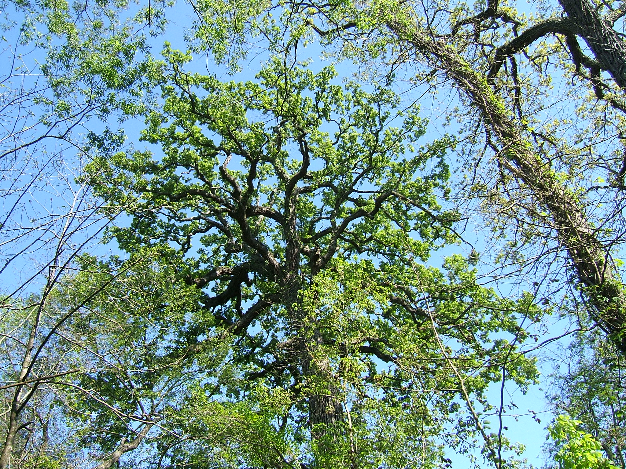
northern Missouri. Here, great old white oaks that were saplings when the first settlers came in search of honey loom over an open understory of prairie grasses, sedges, and wildflowers. Core drillings have revealed one tree that has stood for more than 250 years, and several range up to nearly two centuries in age. It was the white and bur oaks—given their tendency to have hollow trunks and limbs—that provided homes for the wild honeybee.
Paradoxically, the construction of the dam came none too soon to save remnants of northern Missouri’s once vast tallgrass prairie and oak savanna. Now that the Bee Trace area is within a state park, prescribed fires and removal of scrub brush from old farm pastures and woodlots have restored its health and species diversity, making it northeastern Missouri’s most important prairie and savanna landscape. Some 385 acres in the Bee Trace area and an additional 44 acres of prairie on the southwest side of the park have been designated as the Chariton River Hills Natural Area, with more than 250 native plant species and an abundance of birds. The 7.5-mile Bee Trace Trail and the 1.5-mile Little Chariton Prairie Trail provide access to the natural area.
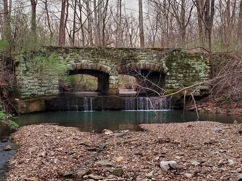
Long Branch State Park also reveals considerable evidence of occupation by American Indians. The drainages are so narrow and steep-sided that there are sites on almost every hill. Just as the environment of northern Missouri was highly structured with narrow fingers of woodland extending along the streams, with the broad sweep of prairie beyond, so too were the locations of American Indian sites. From the Early Archaic period through the Middle Woodland, about nine thousand to fifteen hundred years ago, most sites were occupied seasonally in late summer and fall for large-scale processing of nuts, as indicated by the unusually high concentrations of nutting stones in proportion to projectile points. During the Late Woodland period, the Indians congregated in larger communities along the Missouri River in the summer and fall, and they used the Long Branch area in the winter when they broke into smaller groups. Then during the Mississippian cultural tradition of larger, more permanent towns around Cahokia, Illinois, about ad 9OO to 14OO, Long Branch seems to have been used only for small hunting and fishing camps. On the Chariton River not far from the park, archaeologists have investigated a stone dam and weir that served as a fish trap, possibly built by Missouria or Osage Indians.
Pioneer families hunted the abundant native game and exploited the rivers for fish and fur. For a century or more, the waters were productive, but after World War II, the streams of northern Missouri degraded for subsistence for recreation. Channelization and intensive farming turned them into heavily silted waterways, and drainage from coal mines soured their waters.
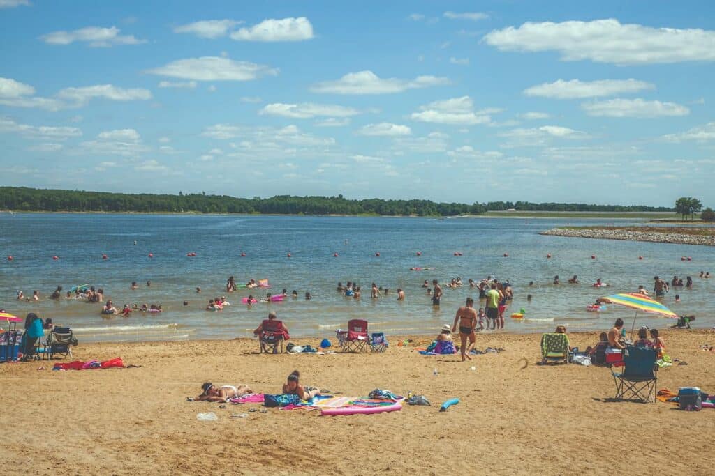
Photo by Ben Nickelson
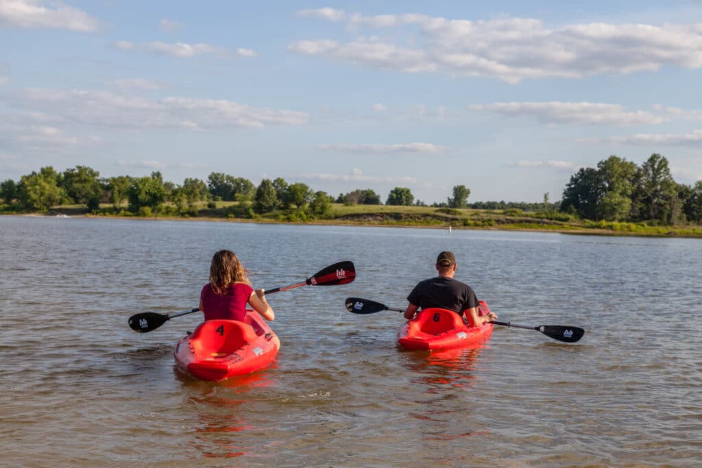
The Army Corps of Engineers project was welcomed by locals. Macon needed water and Long Branch Lake with its sparkling blue water satisfied an ancestral hunger for a good fishing hole. It has become famous for lunker black bass, walleye, and catfish. It is popular also for boating, water-skiing, and swimming. A visit to Long Branch can help you appreciate the environment that is and was in north Missouri.
THE BEE TRACE TRAIL
Between the East Fork Little Chariton River and its sizable tributary, Long Branch, settlers discovered open woodlands well populated with hollow trees that provided nesting places—natural hives—for the American honeybee, first introduced by Europeans but naturalized here. A road through the woods became known as the Bee Trace, the original meaning of “trace” being a beaten path or trail. Settlers came here in the autumn to fell the bee trees and chop them open to harvest the honey. Before the culture and processing of sorghum cane became common, the delectable product of the bee was the sweetening agent most accessible to pioneers. Of course, if they chopped the tree to get the honey, they destroyed the tree and, often, its colony of bees.
Bee trees are scarce now, but portions of the Bee Trace area are still preserved in Long Branch State Park.

LONG BRANCH STATE PARK • 28615 VISITOR CENTER ROAD, MACON
Order Missouri State Parks and Historic Sites book here.
Related Posts
Castlewood State Park
Castlewood State Park has more than thirty miles of hiking and biking trails, eleven of which are open to horseback riders. Experience the feel of a mature floodplain forest with its silver maple, box elder, black willow, white ash, sycamore, slippery elm, and hackberry. Bring a picnic and enjoy the beauty of this park.
Get Out and See Big Oak State Park
You have got to see these trees. Big Oak Tree State Park is home to one national champion, a pumpkin ash, and three state champion trees, overcup oak, sweetgum, and persimmon. The ancient cypress are awe inspiring. The park is also a bird watchers dream with more than 150 known species chirping from the trees.
A True Gem of a State Park
Dedicated in 1938, this gem of a state park now sits amid an expanding suburban landscape and is worthy of a visit any time of year. There are twenty-two CCC-era structures to visit, rocky hills to hike, and massive trees to stop and rest under.

