
The Missouri and Kansas border was a contentious place during the Civil War. Make your way along the trail at this historic site to view the landscape where African Americans fighting in the Civil War earned their place in Missouri—and national—history.

Photo Courtesy of Missouri State Parks
AT MISSOURI’S WESTERN EDGE, the hills that seem to roll in from Kansas don’t amount to much, but a small hill commands a big view. It is this landscape where African Americans fighting in the Civil War earned their place in Missouri—and national—history. The boundary between Kansas and Missouri runs through this country, and while only a line on a map, it was an important line, a significant part of the great national debate—a free soil territory on one side, a slave-holding state on the other. The 1820 Missouri Compromise and the 1854 Kansas-Nebraska Act that nullified it engendered a bloody, vicious conflict along this border between Free-Soilers in Kansas and pro-slavery adherents in Missouri, with nothing separating them but a line on the map. By the time the first shot at Fort Sumter was fired in 1861, a local civil war had already raged along the border for nearly a decade.
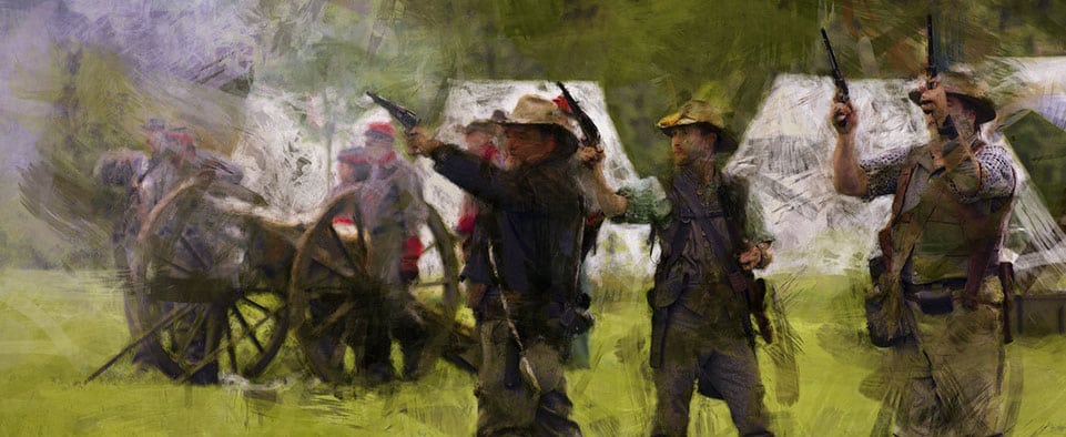
About nine miles east of this border in Missouri lay the Toothman farmstead, the site where on October 27, 1862, 240 blue-clad, black Union soldiers, the First Kansas Colored Volunteer Infantry, en-camped and dubbed the camp Fort Africa. They had been sent to clear out a nest of pro-Southern guerrillas who occupied the ground between a channel of the Marais des Cygnes river and one of its wandering sloughs as a place of refuge and rest and for storage of supplies and loot. And so they did.
The Kansans were outnumbered about two-to-one by some four hundred mounted rebel guerrillas. On the flank of the river mounds, still a mile short of Fort Africa and no cover in sight, the beleaguered African American soldiers formed up and got off one volley of musket fire after another— as the rebel cavalry crashed into and over them—until the horsemen withdrew.
It wasn’t much of a battle, but it was the first time in the Civil War that former slaves had taken up arms and performed admirably as soldiers on the battlefield. In fact, enlisting free black men and exslaves as Union soldiers had been debated since the Civil War began. Acting against President Abraham Lincoln’s wishes and Secretary of War Edwin Stanton’s orders, Kansas Senator Jim Lane, a radical instigator of many ugly border incidents, assembled two regiments of African Americans in 1862 as Kansas units. It was one of these regiments, not yet part of the federal army, at the Battle of Island Mound.

In 2008, the state bought forty acres, the site of Fort Africa, in time to prepare it for dedication on the 2012 sesquicentennial of the battle. The site today features a short trail—aptly named the Courage Trail—that leads out onto restored prairie where there is a view of the mounds on which the fighting took place on a farm adjacent to the site. Farther beyond, but out of sight behind the hills is the river Bottomland.
Today, the countryside is still very open, but the prairie grasses have been mostly replaced by pastures and fields, and there are more trees on the high ground and fewer on the bottoms. A number of wayside markers with photos and maps explaining the battle are located along the trail.
The men of the First Kansas are commemorated in a bronze plaque, and visitors are accommodated with parking, a restroom, and a small pavilion for picnicking. A short stretch of rail fence calls to mind Fort Africa but mainly serves as a reminder that a rail fence was at least half air and didn’t provide much protection from bullets.

Battle of Island Mound State Historic Site
40 acres
Bates County
Trail
• Courage Trail (0.6 mi)
4837 NW County Rd, Butler
To purchase the Missouri State Parks book, click here.
Related Posts

Site of an Early Civil War Battle
The silence that surrounds you at this site belies what happened here during the Civil War. This is where one of the earliest engagements of the Civil War took place. Stand in the spot where the Union fired the final battle shots.

Maple Leaf Festival, Route 66, Civil War Battle, and lots more
Carthage, a town of about 14,400, has more than six hundred homes and historics buildings on the
National Register of Historic Places.
Lexington Invites You to Experience the Spirit of the Civil War
On October 27 Spirit of the Civil War, a community living history event, will truly transform downtown Lexington into its 19th century look and feel. Serving as both a reenactment of the Battle of Lexington and a community fall festival, this event has attractions that will delight visitors of every stripe.