
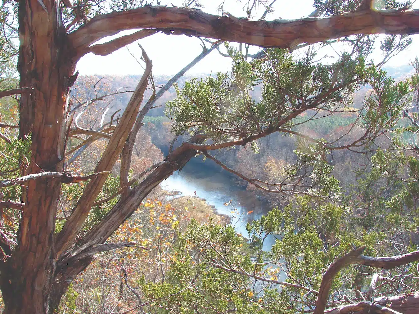
Stockton State Park is 2,175 acres of land leased from the corps and developed for recreation by the state of Missouri. The ultra-clear waters are great for swimming and the fishing is unmatched. Hiking and camping are also one of the many things to do at the stunning state park.

Photo courtesy of Scott Myers
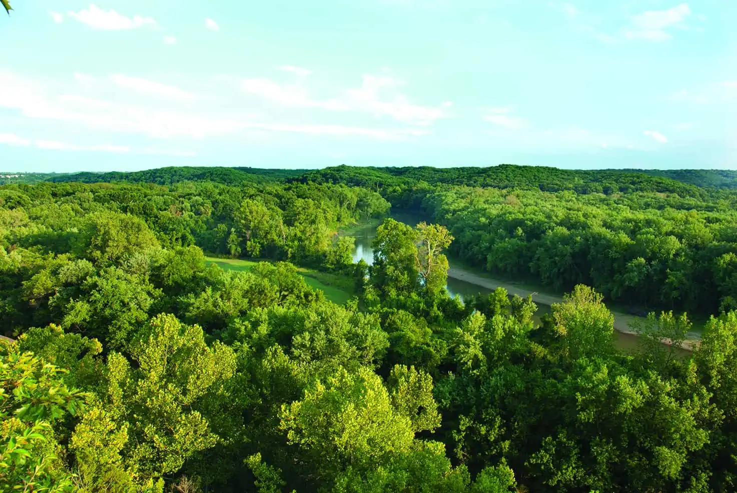
SAILING MAY NOT BE the most common water recreation in Missouri, but a sizable group of freshwater sailors pursue the sport here in southwest Missouri at Stockton Lake, an Army Corps of Engineers reservoir. The lake’s ultra-clear waters and wooded shorelines lure sailors from Missouri and neighboring states.

The full-service marina welcomes visitors. In addition to the traditional campgrounds and picnic areas, the park also offers a camp store, a restaurant on the dock, and several lodging options ranging from duplexes with kitchens to rustic camper cabins.
Beyond sailing, the park is popular with recreational boaters and lake fishermen, who enjoy the unspoiled shoreline and elbow-room of the uncrowded lake. Canoeists and kayakers can spend their time paddling the park’s seven-mile water trail along the shore of a cliff-lined peninsula, with launch points on either side only a mile apart. The park also offers hiking trails with lake vistas and naturalist-led walks, evening programs, and junior-naturalist activities during summer months.

Stockton State Park is located on a long north-south peninsula that once was known as Umber Point, a prominent ridge dividing the valleys of the Sac and Little Sac Rivers in Cedar County. Sources vary about whether Umber derives from a settler’s surname or from the Latin umbra or French ombre, meaning “shady place.” We do know that Cedar County is named for a creek west of the Sac and, in turn, for the eastern red cedar that grows so abundantly all over southwest Missouri. Located in the western Springfield Plateau region of the Ozarks, Cedar County is, in fact, not as shady as some other places, being a transition zone for prairie, savanna, and open woodland.
Extensive archaeology performed in conjunction with the reservoir construction project in the 1960s revealed this area to have a complex prehistory, but one typical of the rest of the Osage River basin. There is evidence of human occupation for at least ten thousand years, with changing ways of life as climate and vegetation changed over time. This was Osage country when French explorers first learned of it in the seventeenth century, but the Cherokee, Chickasaw, and Choctaw from the Southeast moved into the region late in the next century. The area was part of the Osage Cession of 1808, but the first permanent Anglo-American settlements were not established until the 1830s.

The recorded history is meager, but we know that citizens changed the name of the county seat twice, first from Lancaster to Fremont in 1847, shortly after the establishment of the county, and then in 1859 from Fremont to Stockton. Captain John C. Fremont and Commodore Robert F. Stockton were both associated with the conquest of California in 1846 and 1847 during the Mexican-American War. Fremont, the son-in-law of Missouri’s powerful senator Thomas Hart Benton, was leader of the Bear Flag Revolt to establish a Republic of California, and Stockton was the naval officer who proclaimed California a US territory. The name change to Stockton might have been in protest over Fremont’s leadership of anti-slavery forces as the first presidential candidate of the Republican party in 1856. The town was partly burned during the Civil War by Confederate Gen. J. O. Shelby and then later rebuilt.
Apparently, before the turn of the century, a small crossroads settlement named Umber gathered itself into temporary existence on the Umber ridge before fading away after World War II. A few old cemeteries remain on the ridge.
Since the Civil War, the biggest event by far in the county has been the construction of Stockton Lake by the Corps of Engineers. Authorized by the Flood Control Act of 1954 for that purpose and also to provide power, water supply, and recreation, the dam across Sac River was completed in 1972. Since then, the Sac and Little Sac Rivers have formed one of the clearest lakes in the state. Umber Point is now in the state park, and sailboats brighten the breezy waters on sunny summer days.

Photo courtesy of George Denniston
Many claim Stockton Lake lowers the best sailing in the lower Midwest. The key is the steady southwest breeze off the Springfield Plateau that sweeps over 25,000 acres of open water.

STOCKTON STATE PARK • 19100 HIGHWAY 215, DADEVILLE
Featured image: The state park marina rents boats of all types for sailing, fishing, cruising, or paddling.
Photo by Scott Myers
Read more about sailing on Stockton Lake here.
Click here to purchase the Missouri State Parks and Historic Sites book.
Related Posts
The Diverse Current River State Park
The richly diverse Current River State Park has almost two miles of Current River frontage and a superb trail network. The fishing is abundant and a lazy float down the Current River is a perfect way to spend any day of the week.
Castlewood State Park
Castlewood State Park has more than thirty miles of hiking and biking trails, eleven of which are open to horseback riders. Experience the feel of a mature floodplain forest with its silver maple, box elder, black willow, white ash, sycamore, slippery elm, and hackberry. Bring a picnic and enjoy the beauty of this park.

Get Out and See Big Oak State Park
You have got to see these trees. Big Oak Tree State Park is home to one national champion, a pumpkin ash, and three state champion trees, overcup oak, sweetgum, and persimmon. The ancient cypress are awe inspiring. The park is also a bird watchers dream with more than 150 known species chirping from the trees.