
At Cuivre River State Park you can take in the sweeping views, set up camp, go swimming and fishing, and visit American Indian campsites and burail grounds. Spend some time at Lincoln Hills Natural Area–the park’s crown jewel.

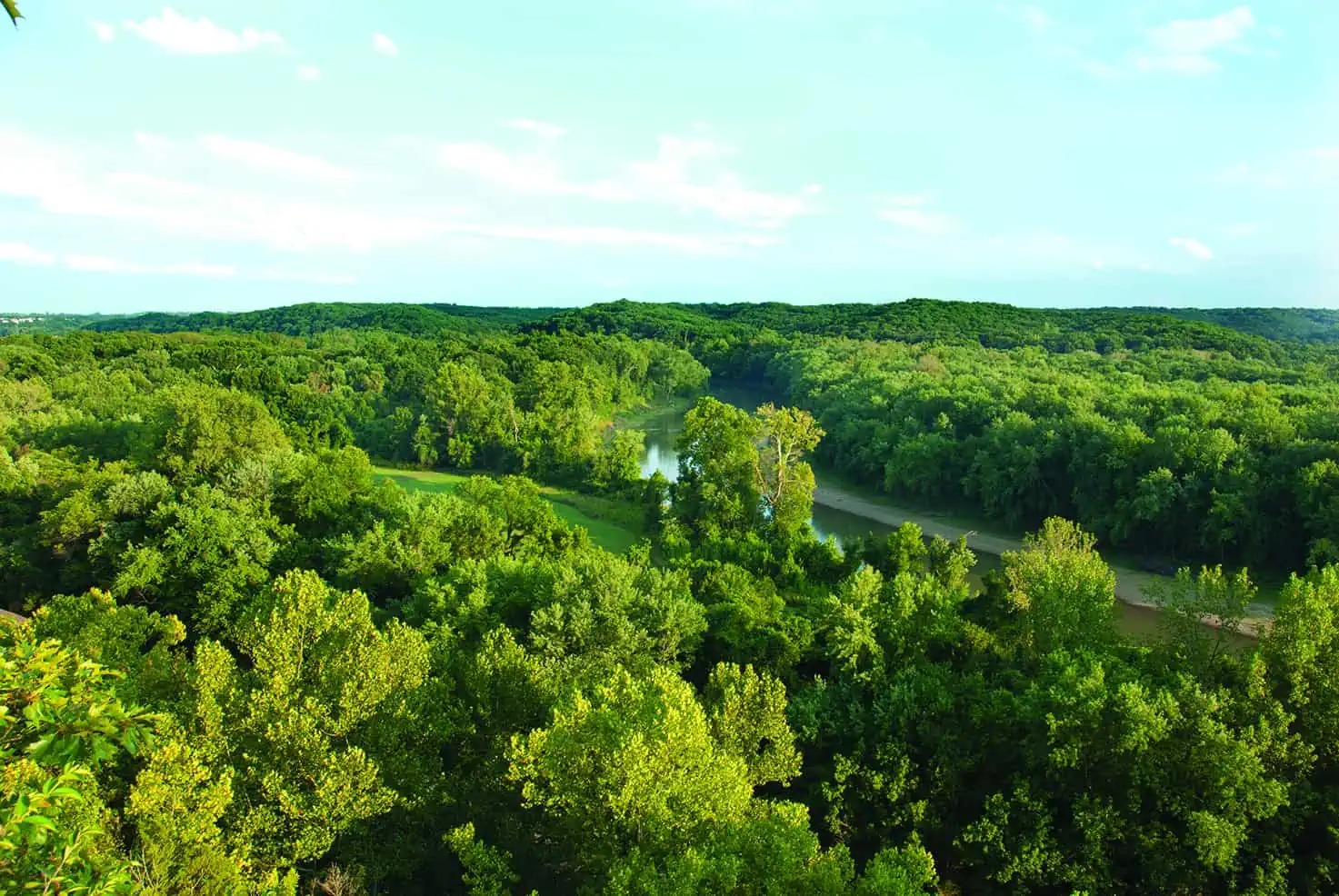
CUIVRE RIVER BARELY TOUCHES the southwestern edge of the state park that bears its name in Lincoln County. But the juxtaposition is dramatic: a high cliff of Mississippian limestone known locally as Frenchman’s Bluff drops off sharply to the river. From the vantage point of the park, one can take in a sweeping view.
Such striking topography may, at first, seem out of place north of the Missouri River. The rugged land- scape, the rich woodlands, the limestone glades, the upland sinkhole ponds: all seem more representative of the Ozarks region south of the river. But Cuivre (pronounced quiver) River State Park is located at the southern end of a sixty-mile stretch of uplifted bedrock known as the Lincoln Hills. While continental glaciers scoured and buried the land north of the Missouri River with debris, the Lincoln Hills somehow escaped most of this.
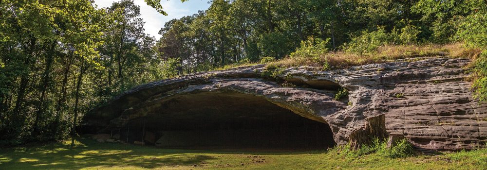
American Indians arrived in the area as early as ten thousand years ago, and archaeologists have iden- tified their villages, campsites, burial mounds, and ceremonial areas in and around the park. French ex- plorers and settlers came next, hence the names for the bluff and the river: cuivre means copper in French, but some think the river was originally named in honor of Georges Cuvier, a noted French paleontologist and naturalist.

Cuivre River is one of three state parks initially acquired by the National Park Service as Recreation Demonstration Areas (RDAs) through the 1933 National Industrial Recovery Act. RDAs were supposed to provide economic and work relief by developing parks from sub-marginal farmland near cities to give urban residents opportunities for outdoor recreation. The lands at Cuivre had been cutover and eroded,
with the valleys planted with crops and the uplands grazed by cattle. Today, after decades of careful stew- ardship, the park is recognized as one of the most ecologically significant and biologically diverse parks in Missouri.
Two New Deal agencies, the Civilian Conservation Corps (CCC) and the Works Progress Administration, built many of the park’s facilities. Camp Sherwood Forest, designed and built in cooperation with the Park and Playground Association of St. Louis, is a perfect example of the traditional New Deal group camp. Fifty-three CCC buildings and other structures still remain, most restored for use.

Cuivre River State Park, with its restored and preserved natural communities and cultural resources, is an ideal setting in which to learn the meaning of resource stewardship. One might begin with a trip along the main park roads, where the New Deal relief workers in the 1930s painstakingly constructed masonry structures to direct water flow from one side of the road to the other. Much of their engineering is now enrolled on the National Register of Historic Places.

Photo by Bruce Schuette
Even the entrance to the park is special. Following a narrow corridor of public land north from Route 47, you gently withdraw from the workaday world into peaceful wooded hills and valleys. When you cross the hand-crafted triple-arched stone bridge over Little Sugar Creek, day-to-day cares seem distant. Cuivre River is a park of hope, where nature has regenerated, and people may too.
In 1978 a small natural area was designated to protect Pickerelweed Pond, a three-quarter-acre pond. By 1997 it had been expanded to the 1,872-acre Lincoln Hills Natural Area—the park’s crown jewel.
Cuivre River State Park has camping, fishing, hiking, biking, and horseback trails, a picnic area, swimming, boating, a playground, floating and kayaking, orienteering, and a visitors center.

Cuivre River State Park
678 State Rt. 147, Troy
6,427 acres
Lincoln County
Trails
• Big Sugar Creek Trail (3.75 mi)
• Blackhawk Point Trail (5.75 mi)
• Blazing Star Trail (2 mi)
• Cuivre River Trail (11.25 mi)
• Frenchman’s Bluff (1.5 mi)
• Hamilton Hollow Trail (0.9 mi)
• Lakeside Trail (3.5 mi)
• Lone Spring Trail (5.2 mi)
• Mossy Hill Trail (0.8 mi)
• Prairie Trail (0.3 mi)
• Turkey Hollow Trail (0.8 mi)
• Old Schoolhouse Trail (3.85 mi)
Historic Structures
• CCC and WPA bridges, groupcamps, a shelter, and more
Featured Photo Courtesy of Missouri State Parks.
Purchase the Missouri State Parks Special Edition book here.
Read more about Cuivre River State Park here.
Related Posts
Castlewood State Park
Castlewood State Park has more than thirty miles of hiking and biking trails, eleven of which are open to horseback riders. Experience the feel of a mature floodplain forest with its silver maple, box elder, black willow, white ash, sycamore, slippery elm, and hackberry. Bring a picnic and enjoy the beauty of this park.

Visit Cuivre River State Park
Cuivre River State Park consists of more than 6,400 acres centered on Big Sugar Creek, a tributary of Cuivre River. A dozen different hiking, backpacking, biking, and equestrian trails total some thirty-five miles make this park a great place to visit.
Hiking Graham Cave State Park
Head over to Graham Cave State Park to walk in the footsteps of early Missourians.